Saturday, July 9, 2016

More "Wows" (part 5 of ?) (3/1/2015 to 4/28/2015)

Location: New Rockdale RV Park; Mansfield, Louisiana

Today is day 83 since Brandon's second stroke. Therapy is still happening 3 times a week with small improvements still being noticed. He has completely claimed his independence by driving himself to restaurants and walking in alone. All of the restaurant employees in Mansfield know him and will assist him if needed. He has driven into the edge of Shreveport to get some Taco Bell. I guess the acorn doesn't fall far from the tree. :)   

This post is a continuation in a series of posts. Since I have been stationary for a while, I have taken that opportunity to organize my past travels. This series of post is a result of that organization. It will prove useful to the future. Although I have chosen some pictures to represent some of the "wows", they do not come close to representing everything I saw. The map is a useful tool to isolate a particular place by date. Using that date you can utilize the archive located in the right panel of the blog to find the more detailed blog entry about that place. 

It is a bit of a chore going through all of the pictures, but it is enjoyable to remember specific places. Sometimes, my mind can drift right back there and experience the sights, sounds, smells and vibrations of the place. I hope you enjoy them too. 


This is the route for this part. Unlike most of the eastern U.S. trip, these were all new states for me. I really enjoyed this part.

Air Force One at the Reagan Library. Excellent visit. 

This picture is an attempt to represent the Central Valley of California. It was shocking as to the size of the valley and the wide variety of crops being grown. I never thought of California as an agricultural state before.

A trip into the Sierra Nevada Mountains.

The Giant Sequoyas. I liked them much better than their cousins, The Coastal Redwoods.

A drive among the Giants. That is a Sequoya on the right. It was early spring and snow was everywhere in the higher elevations. I think I timed it perfect, except Yosemite was snowed in and I missed seeing it.

Large irrigation systems are all over the central valley. Blue ribbons of water.

The Pacific Ocean

Part of the Pacific Coast Highway


The Golden Gate Bridge. It is worth seeing.


More of the Pacific Ocean

Port Cabrillo Lighthouse

More Pacific Ocean


The beaches were mostly deserted due to the chilly weather, however I did find one person. :)


I don't remember the name of this lighthouse but it is near Crescent City, CA


More Pacific Ocean view. I think this is crescent shape of the beach may contribute to the name of the nearby town, Crescent City.

These people put in some time and effort. I think it paid off with a "wow".

A fellow "traveler". His owner was inside using the free WiFi. I'm not flat-belly enough to do that much walking

More Pacific Ocean. I hope it's not too boring.


A brave young lady screaming while she ran into the chilly water. She was laughing loud and having a good time.


One of the better sunsets I saw. That is what's left of an old shipwreck on the beach.

A replica of the campsite Lewis and Clark stayed at after seeing the Pacific Ocean

Sun setting of the Pacific Ocean. That is the rock jetty that protects the mouth of the Columbia River. In the distance is a large ship that just exited the river.

This is after I turned east from the ocean and following the Columbia River. Waterfalls are common to the area, but this is a very popular one right along the interstate. It is Multnomah Falls which is the tallest in Oregon.

The Columbia River.
It is without a doubt, the most beautiful river I've seen.


Bonneville Dam.
Worth a visit, even for non-engineers

Statue of Sacajawea, her baby and Captain Lewis's dog named Seaman. She has statues all over the northwest, but I liked this one the best.  

The Painted Hills.
This is just one of many, many hills with different colors.

I took a day trip to see Three Sisters. That's them in the distance. I found a beautiful mountain stream that was raging. 

Crater Lake.
No pictures can capture the beauty or the color.

White capped mountains everywhere you look.

I followed this RV for a while. Although I don't know them, I can relate to them as an RV traveler. To me this picture represents all RV'ers that are traveling down the road to the unknown; all the while breathing in that sweet smell of Freedom. 

Ya'll take care of each other. I'll Cya down the road.



Saturday, July 2, 2016

More "Wows" (Part 4 of ?) (11/30/2014 to 3/1/2015)

Location: New Rockdale RV Park; Mansfield, Louisiana

Today is day 75 since Brandon's second stroke. Small improvements continue with Physical/Occupational/Speech therapy and we remain hopeful. Looks like I may be back on the road in a few weeks. Time and circumstance will tell.

This post is a continuation in a series of posts. Since I have been stationary for a while, I have taken that opportunity to organize my past travels into these posts. It will be very useful for me in the future. Although I have chosen some pictures that represent some of the places where I visited, it in no way completely captures that place. If you want to see more pictures of a particular place, you can use this map or others on this blog to help isolate the date, then use the archives located on the right side of each post to locate that date. It is the best I can do for right now. 


This route is from after Thanksgiving of 2014 to early Spring of 2015. I stayed at about a dozen Texas State Parks before heading to the southwest U.S. 


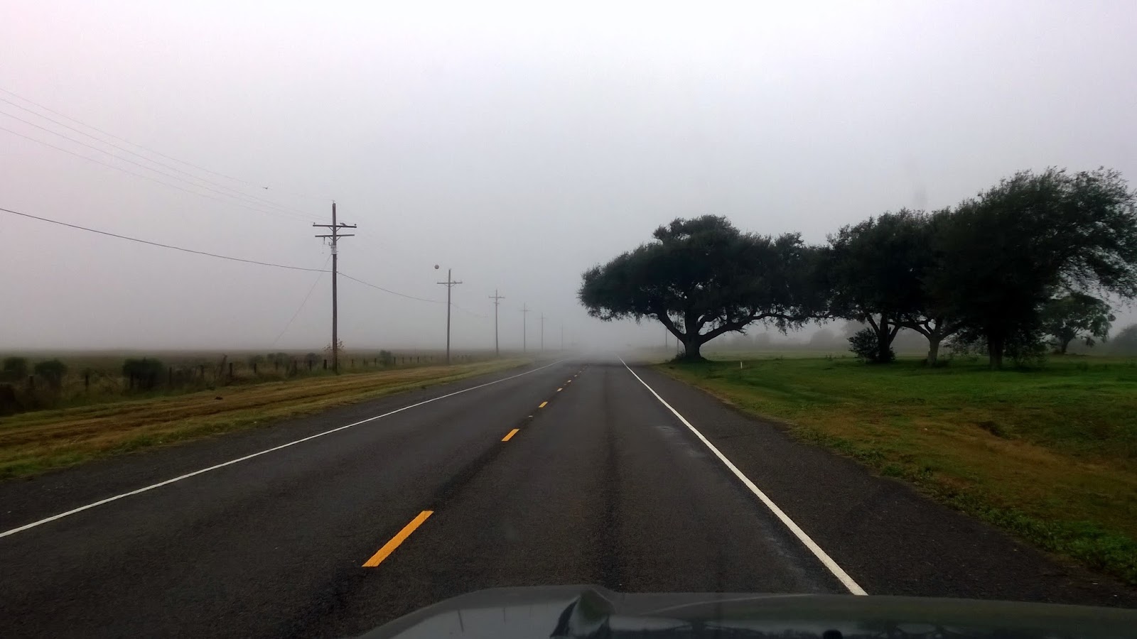
I chose this picture to represent the Gulf coast of South-east Texas and South-west Louisiana. It is the road to Sea Rim State Park. I didn't stay there and only visited, but this foggy morning on this lonely strip of road says it all. It is worth the trip.

I was camped at McKinney Falls State Park in Austin, Texas when all the hub-bub was going around the country concerning supposedly police mis-treatment. I found myself at this memorial, which seemed appropriate. It is the Texas Peace Officers' Memorial for all the Texas police who have given their lives in service to the public. Not a single person was at this memorial, but thankfully, neither were any protesters. 

Sunrise over the Gulf of Mexico while parked on the beach. Mustang Island State Park is perfect for these early morning times. It is great to be able to drive for miles on the beach to find a great spot. 

This is the disappearing water at Goose Island State Park. Aransas Bay is there for as far as you can see, but at this moment in time, the water was so still, it acted as a mirror to reflect the clouds making it seem as though the water disappeared and the horizon disappeared. It was amazing.

Although this is a peaceful looking picture. It is at the Presidio near Goliad. Several hundred men, fighting for the independence of Texas were murdered here. It was much worse than the Alamo and is barely remembered. It is a shame to forget history.

Wildlife was everywhere while staying at Choke Canyon State Park

Clouds before a sunset at Lake Corpus Christi State Park. Can you see what looks like a "screaming eagle" with wings spread over the entire width of the picture? 

Javalinas wandering through the campground at Falcon State Park. After talking with some of the Border Patrol Agents and State Police, I don't think I will be back to this state park. The positives of the place do not outweigh the negatives.

Sunset over Lake Casa Blanco at Laredo, Texas. Although it was also very near the border, safety was not as much a concern as was at Falcon.

The Pecos River. 

Seminole Canyon State Park. It represents the arid desert part of west Texas. It is also the only campground in all my travels where I could not pick up a reliable cell signal. 
A weather front passing through West Texas. I've been to Wyoming and Montana, but the skies in Texas are also "Big". :)

More West Texas with the Davis Mountains in the distance

Looking out a window of a CCC built building at Davis Mountain State Park. It was a very peaceful place with great views. 

After the sparsely populated areas of rural west Texas, your mind gets a jolt when you get to El Paso. That is old Mexico in the distance.

The Saguaros of Arizona.  

Tomestone and the shootout at the O.K. Corral. 

Arizona, the land of sunsets. :)

I went to Sedona in search of "vortexes" and instead found a peaceful spot where a Buddist Stupa was located. I admit there was a sudden calming of the spirit as I walked up the hill to this place. It is a place to return.


Can't go to Arizona without wandering in the desert, albeit on a long dusty dirt road. This is Chicken Springs Road that heads west out of Wikieup, Arizona. I camped in the area so that I could drive the road I had seen on Google Earth. It was a day well spent.

Hoover Dam.
Well worth a visit and takes almost a whole day

Las Vegas.
Fremont Street was interesting, other than that, it was a nice layover in a big city.

Airplane tour of the Grand Canyon. At first I wasn't sure if it was going to be worth the expense, but it was. I'm glad I did.

The Colorado River at the bottom of the Grand Canyon. 


That ends this post. These summaries are harder to do than I anticipated. Trying to choose from so many pictures is very tough. I will see a picture and it will make me think of the place and I will start going through all of the pictures. I guess simple minds are distracted easily. :)

Ya'll take care of each other. I'll Cya down the road.