Wednesday, April 26, 2023

How I Plan a Trip (part 1)

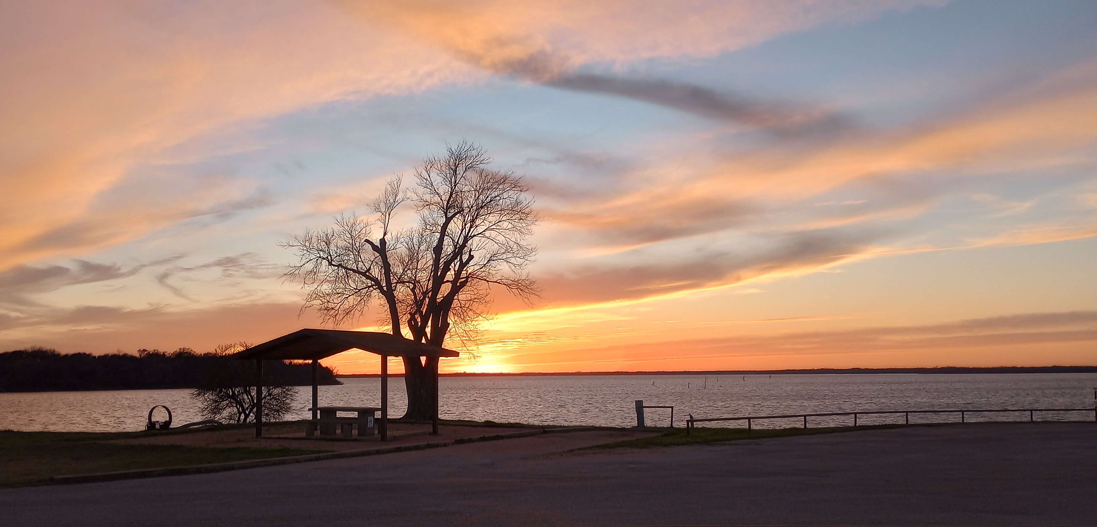
Location: New Rockdale RV Park; Mansfield, Louisiana

I've been back at my home base for about two weeks and it's time to start doing some preliminary planning for my next trip. Over the years, I've had several people ask me how I plan a trip. Everyone is different and their planning reflects their differences. For me, I think planning out the route, campgrounds and places to see is fun, so I probably do more than most.  

The start date of the trip depends on my scheduled visits with my doctors, a little maintenance work/upgrades on Freedom/Liberty2, some visits with my grandbabies and taking care of a few personal financial matters. My monthly rent at this campground is due on the 11th of the month, so the earliest I plan to leave is May 11th and the latest being June 11th. If I want to, I can leave anytime and this campground will give me credit for days that I've already paid. I am also tracking the long range weather forecast to see when the first 90 degree day is forecasted for this area. I would like to avoid anyplace hotter than 90 degrees, if possible. Right now, the first 90 degree day is May 31th. Dang, right in the middle of 5/11 and 6/11. Oh well, I don't have to establish a leave date for another week or so. I want to make campground reservations at least a month or more in advance since it will be summertime. 

One of the first things I do when planning a trip is to pick a long range destination. On this trip, it will be Goshen, Indiana. Specifically, Elkhart County Fairgrounds. That is the site of the annual Forest River Owners Group (FROG) rally. I've attended three of them in the past and look forward to attending it this year if,,,, as my mother would have said, "the Lord's willing and the creek don't rise". Registration for the rally begins at noon on 4/26/23. I plan to register as soon as possible due to the large interest in this rally. I think there were over 600 RV's at the last one I attended, so registration slots go fast. The rally is a great learning and visiting event.

The dates of the previous rallys are ,,,Aug 2014, Aug 2016 and Aug 2017,,, you can use those dates to find the posts I wrote about them. Look for those dates over yonder >>>>>>>>>>>>>>>>>>>>.

One of the main computer programs I use to do trip planning is RV Parky. It used to be a completely free program but they recently started charging $20.00 a year. You can still do it for free but with limited features. The $20 is worth it to me.

This is a picture of RV Parky after entering the starting and ending points. This is theoretically the fastest route. I don't like this route because I've taken it before and I don't like to back track without a purpose. Also, I'm not going through Chicago because Liberty2 doesn't look good with bullet holes. 
 

If I leave here on June 11th and the rally starts on August 11th, that means I have about 60 days+/- to get there. I plan to stay about 3 to 4 days per campground, so I need to find about 15 to 20 campgrounds. Without going through Arkansas, my only other real choice is to head east on I-20. This is the route I took when I first hit the road full-timing back in April of 2014. So, sentimental old me thinks I'll stay at the campground I stayed in back then. That would be Poverty Point State Park near Delhi, Louisiana. It would be about a 160 mile tow, mainly on interstate highway, which is ideal for me on day one of a trip. It will give me time to comfortably kick back with cruise control while listening to the "song of the road". I will also be listening to see if Freedom/Liberty2 says anything about their traveling condition. 

The way RV Parky works is I can search for campgrounds, gas stations or stores along the route, click on them and add them to my trip. The program will calculate the distance between campgrounds. The first thing that came to mind to see on the way to Goshen is the Noah's Ark recreation located a little north of Lexington, Kentucky. Since I can't use something like that as a waypoint, I had to enter a Walmart near the Ark to have it show up on their map. 

This is the picture of the route with Noah's Ark at waypoint #2 and Poverty Point State Park as waypoint #1. This is the first general route.
 

The general route in the above picture takes me through a large part of Tennessee. One of the trips on my list of places to see is the Tennessee River Valley. The Tennessee River runs from near Knoxville, Tennessee to the southwest and passes through Alabama and Mississippi before re-entering Tennessee and then runs almost north to the point where it empties into the Ohio River near Paducah, Kentucky.

The crazy route of the Tennessee River.

One of the few successful programs that President Roosevelt implemented during the "Great Depression" with his "New Deal" was the Tennessee Valley Authority (TVA). The congressional act creating the TVA was signed 90 years ago in 1933. It's purpose was to make the Tennessee River navigable by creating 9 hydroelectric dams on the main river along with some secondary dams on its tributaries. These dams would help control flooding, create electricity, increase recreation, re-forestation of the valley, economical reasons for businesses to locate in the valley and create a lot of construction jobs. More about the TVA as I explore the valley.

So, the trip to Goshen will go through the Tennessee Valley. I'll visit as many of the dams as I can and camp at TVA campgrounds along with my prefered COE campgrounds.

This picture is from Google Earth showing the 9 main channel dams plus 2 additional ones. The Kentucky Dam is too far to the north of my route, so I won't be exploring there. But the others are generally in line, so we will see how many I can get to.

This is RV Parky again with waypoints 3 and 4 being the 1st and last dam site campgrounds. Point #2 is Roosevelt State park. I'm stopping there for two reasons, one is the name, Roosevelt. Although he is not my favorite President, I give him credit for launching the TVA. The second reason is it is located in Morton, Mississippi which is the city in which my father was born. The closest I've been to it is passing by along the interstate. Point #5 is Noah's Ark and #6 is Goshen.

The RV Parky picture above is the backbone of the trip. I will need to find campgrounds in between those waypoints so as to reduce my towing distance to about 100 to 150 miles. 

This is enough planning for now. I'll continue to fill in the gaps and begin to make reservations after a couple local events that could determine when the trip begins and if I even go on the trip. I guess that will be part 2.

Ya'll take care of each other. Maybe, I'll Cya down the road.  


Sunday, April 9, 2023

Trip Wrap-up and Top 10 Sunsets/Sunrises

 Location: Sandy Creek Campground (COE); Jasper, Texas

Tomorrow is my last day here at Sandy Creek. I took a ride to see something yesterday, but other than that I've just been taking it easy. This post will give a few travel statistics and the top 10 sunrises/sunsets. 

This trip began on February 12 and ends on April 11th. The miles Liberty2 was towed, including the final leg on Tuesday, will be just under 1,500 miles. I've stayed in 15 campgrounds of which 9 were Corps of Engineers, 3 were State Parks and 3 were City/County owned. Zero were privately owned campgrounds, which I like that stat. The average mileage between campgrounds was 92 and average stay was 4 days. The average campground cost was $15.00 per day which is very reasonable. I reinforced a lesson previously learned in that making reservations is a must now-a-days. The only campground I had bad "ju-ju" with was Copperas Creek COE campground near the town of Comanche, Texas. That's that number 4 out in left field on the map below. Oh well, 14 good ones out of 15 is pretty good odds for campgrounds.


One of the good things about camping at COE campgrounds is they are usually near a body of water, which if you plan it right, offer some good sunsets and sunrises. The following are the top 10 from this trip in order of campgrounds.

Buckhorn Creek Campground

Buckhorn Creek Campground

Liberty Hill Campground

East Lofers Bend Campground

East Lofers Bend Campground

Copperas Creek Campground

Midway Park Campground

Midway Park Campground

Magnolia Beach Campgroiund

Mustang Island Campground
Happy Easter to everyone. He is risen.

Ya'll take care of each other. Maybe I'll Cya down the road.

Saturday, April 8, 2023

Wind, Rain, Woods & Bad Power.

 Location: Sandy Creek Campground (COE); Jasper, Texas

I put Galveston in my side mirror early in the morning. I had been monitoring the weather for a few days. There was a strong cold front headed my way and it was anticipated to stall right on top of the coast. High winds and heavy rains were predicted for the coast and about 75 miles inland. The winds bothered me most because they were saying gusts may get as high as 45-50 mph. Flooding was also predicted for the county where my next campground was located. Hmmm,,,, best to get hitched up early so I would have more options to "wait and see" or "make a run for it". 

I started hitching up around 8:00 am in the dry. The front had stalled north and west of Galveston by about 30 miles. That was good news. The bad news it was stalled about 5 miles north of the campground I was heading towards. The towing would take about 3 hours so it was unpredictable what the front would do while I driving to the next campground. After getting hitched, I decided to make a run for it and monitor the weather as I drove. Hey, I didn't break the law by texting, I was just looking at my weather app. I knew I could stop somewhere along the way if the front decided to move south into my area of travel. 

Surprisingly, the front, with strong thunderstorms training to the northeast, stayed about 10 miles north of the campground for my entire trip. After arriving early and getting Liberty2 set up, the rains came and it's been raining on and off since. Someone, with some pull upstairs, kept the storms and high winds off of me until I could get set up. Thanks ya'll.

I can't visit Galveston Island without driving by the "teapot house". I'm glad to see the people who fixed it up a few years ago is still doing a good job. For a decade or more, it was just rusting away.

Last view of the seawall with an angry Gulf of Mexico.

I only rode the Bolivar Ferry once on this trip and it was while I was leaving. Notice the ocean going ships at anchor in the background. They are waiting their turn to enter the Port of Houston. I learned about a website named "Harbor Traffic" when I was up in the Great Lakes area. It will give you information about the ships. It also works for the inland rivers and waterways. 

This picture was taken from the observation deck of the ferry. As usual, I was able to look directly down on Liberty2's roof. I took some pictures of the roof for documentation. 

After leaving the beach houses in the Crystal Beach area, there is about 15 miles of smooth road running parallel to the beach. 

The Gulf is threatening to take out the road and Texdot is fighting back with tons of rip-rap. Several decades ago, this road use to go all the way to Port Arthur but the Gulf took it and TexDot gave it back to the gulf. That beach house structure is the last one before reaching the city of High Island. 

 I even took a chance and stopped at a Walmart in Woodville, Texas, which is about 15 miles from the campground. I needed to stock up on some things for my 5 day stay in case the weather kept me confined to the campground. Half of the parking lot was blocked off while they were setting up outdoor products which confined all parking into one area. I had to circle back out to the highway and re-enter the parking lot before finding a place big enough for Liberty2 to park. I've never had an experience in a Walmart like this one. The majority of patrons were senior citizens and most were very rude. While I was going down aisles looking for something, two different people hurried me along by almost bumping my heels with their buggy (that's a shopping cart for my Yankee friends). Two ladies cut in front of me on an aisle then just stopped to shop. Since there was someone coming the other direction, I just had to wait. I got what I needed and put it directly into Liberty2's refrigerator. I'll remember this bad shopping experience for a while and will not be back to the Walmart in Woodville.

This campground is tucked away nicely in the woods alongside Steinhagen Reservoir. There is about 2 miles of very rough county road before getting to the campground entrance. A lot of the area inside the campground has standing water from the last storms and current rain. I was hoping my campsite wasn't flooded and I was please to see it dry. It was an easy back in site with a level spot to park. On Friday, I thought the power had went off due to storms but after about an hour I went to check the pedestal and found out my Surge Guard had trip. The breaker in the box hadn't tripped so I thought maybe my Surge Guard went kaput. I took it to an empty site, plugged it in and it worked just fine. I returned to my campsite and reconnected. My Surge Guard went a little crazy before turning off. I then heard some crackling inside the pedestal box and was pretty sure some of the wires were arcing. I told the camp hosts about it and thought, since it was Good Friday, I would have to wait at least a day. More surprises. They said a Corps of Engineer electrician was on duty and would be there soon. Within 30 minutes, he showed up, looked inside the box, saw some melted wires and replaced everything. Afterwards, everything worked fine including my Surge Guard. From the time of reporting the problem, to me having power enough to turn on my ceramic heater (50 degrees), was about 2 hours. I was very impressed.


Peacefully tuck back into the woods.

This is the lake shore about 50 yards from my campsite.

Looking the other way along the shore.

Today is day 3 of 5 at this campground. My next stop will be my home-base in Mansfield, Louisiana. I'll try to do a trip wrap up post before I leave here. 

Ya'll take care of each other. Maybe, I'll Cya down the road. 

Wednesday, April 5, 2023

Galveston, An Old Storm & an Orphanage

 Location: Galveston Island State Park; Galveston, Texas

Today is day 4 of 4 here at Galveston State Park. I've been to Galveston so many times that I didn't do much exploring. I did go to a museum that struck my fancy about a subject I had heard about. Wasn't that a mysterious sentence. By the way, I thought "struck my fancy" was a southern phrase but it turns out to be an old English one from old England.

Galveston Island State Park was rebuilt a couple of years ago and is nothing like it was when I stayed here right after buying Liberty.

All paved campsites with water and electric. They also have a boondocking area where I was planning to stay until the temperatures warmed up. 

This is one of three streets of Water/Electric sites. The end of the road has walking access to the beach. That's Liberty2 on the left, three RV's down.

This is from the walkway to the beach. The beach and water is about 50 yards behind me.

They also have a tent camping area as well as tent/yurt rentals.

The walkway from the campground to the beach.


A couple of the campers feeding the gulls. Once she started, gulls came to here from everywhere.

Although a little uncomfortable, this was a good "thinking" bench while watching the waves come in.

The most deadly natural disaster occurred right here in Galveston. I was aware of it happening but not many of the details. The disaster is known as the Great Galveston Storm or the Hurricane of 1900. It destroyed almost everything on the island with the storm surge sweeping many things and people out to sea. It killed between 6,000 and 12,000 people. To put those numbers into modern perspective, about 3,000 people died on 9/11, about 1,400 people died during Hurricane Katrina. I can't remember if I learned about the storm from school while growing up or if I learned about it later in life. It seems it should have at least been mentioned in school. If anyone remembers for sure, let me know. 

The story I wanted more information about was concerning the orphanage during the storm. I read about the local museum having a nice display with information about the storm so I went to see. The little museum is located in the Galveston County Courthouse building. The Courthouse is easy to find, but there are no signs to indicate where the museum is until you enter the building. I told the guy at the entrance to the museum that they needed better signage, he said the county would not let them put any signs up outside. Strange, but true.

I'll try to be as brief as possible. The Yellow Fever swept across Texas in the late 1800's killing thousands. It began in the large port city of Indianola, very near Magnolia Beach where I stayed for a couple days. From there it headed north toward Galveston and Central Texas. The fever killed many parents thereby creating orphans. In Galveston, the local hospital was staffed by Catholic Nuns which ran the orphanage as part of the hospital. It was decided to create a stand alone orphanage away from the hospital to protect the children from being exposed to the fever. So they bought some land a few miles south of the hospital where they used some of the pre-existing buildings along with some newly built ones, to house the orphans. Currently, Walmart sits on that land. 

There were 93 orphans of varying ages when the storm hit. When the waves started destroying the buildings, the Nuns tied the children to each other and then to themselves using clotheslines. For days after the storm, dead children were being found still tied with the clothesline to each other and a Nun. They had become entangled around trees, stumps, fences and storm debris. There were 10 nuns and 90 children that died. It is unimaginable the horror and fear those children went through during that storm. Why wouldn't the most deadly disaster be taught in school? It's just plumb sad.

By the way, the Sisters of Charity of the Incarnate are stationed all over the world. And on September the 8th, no matter where they are, they all sing an old French hymn named "Queen of the Waves" in remembrance of those who died during the Great Storm. One year the singing will probably end, but I hope it doesn't. 

I won't post any pictures about the storm because it is too depressing. Just know that many lost their lives on that day and this story of the orphans is just one of many.

I reread my last post about being concerned about crossing the San Luis Bridge. The bridge was no problem, with plenty of room but it would be nice if they would paint some edge lines. All roads with eleven foot lanes or wider are suppose to have edge lines. When looking down on a satellite view of the bridge and not seeing any edge lines made me worry they were nine or ten foot lanes. The toll booth was very tight with about 6 inches to spare on each side of Liberty2's tires. Trying to get the two dollars for the toll in the the cash tray during strong winds was also fun. Everything was hazy that day and pictures were not clear. I'll post them anyhow. Come to think of it, it has been hazy with overcast skies for about a week or so. There is a strong cold front due to blow through here this evening and tonight so that may clear things up.

The toll booth on the San Luis Bridge. Tight fit, but doable. Going this way avoids Houston totally.

Tomorrow is moving day and I'll be going to my last stop before getting back to my homebase town of Mansfield. It will be another COE campground. I usually use the last campground as a trip decompression place. I hope it is a good one. I'll probably be dodging storms since they are in the forecast for the next 4 days. 

Ya'll take care of each other. Maybe I'll Cya down the road.


Sunday, April 2, 2023

Success!!! The Third Time is a Charm

 Location: Quintano County Beach Campground; Freeport, TX

Today is moving day but the tow will only be about 1 1/2 hours, so I can leave around noon (It's 9:00 now). 

I checked the tide table last night and discovered low tide was around 8:00 am this morning with sunrise a little after 7:00 am. That cinched it for me, I would attempt to walk the jetty again. I've stayed at this campground two time before this current stay. Once on March 17, 2019 and again on February 15, 2020. Using those two dates, you can easily call up the posts from the archive listing on the right hand side panel. Both times I stayed here I attempted to walk to the end of the jetty, but failed miserably. Both times I made it about 3/4 of the way to the end before the waves began crashing over the jetty which forced me to turn around. On my last visit, I said I wouldn't be back for a third try. I inadvertently lied, almost like a politician, because I tried again this morning. As a bonus, I checked the "marine traffic" website and saw that a tanker was due to arrive at Freeport around 7:00 am. That would make it a trifecta; low tide, sunrise and a ship arrival. 

Well, one out of three ain't good, but it also ain't bad. The sky was a little foggy/hazy so the sun never made an appearance and something must have happened to the tanker because it also was a no-show. But, nothing stops the tide so I left the campground around 6:30 am and arrived at the beginning of the jetty 5 minutes later. I was surprised to find a dozen vehicles already there and fishermen everywhere. I definitely wasn't going to be alone on my jetty walk like I had been the previous two times. Most of the time I prefer being alone on things like this, but I had been having some bad vibes about making this walk alone. Not to question vibes, but that one proved to be wrong.

I made it to the end easily and talked with fishermen along the way. They told me they were catching Spanish Mackerel and Sheepheads. For the 30 minutes I was on the last half of the jetty, I saw at least a dozen fish being caught. One thing I noticed, or felt, was a few of the fishermen seemed suspicious of me. I wasn't sure if it was because I had a cell phone camera and no fishing pole or they thought I was an undercover ICE agent. There were only a few that seemed suspicious, the rest were very friendly and proud to show off the fish they caught.

The beginning of the jetty. I light at the end was a portable light stand that a couple of fishermen had with them. I asked if they had been out all night, they said, 'most of it'.

The guy of the left eagle eyed me the entire time I was there. The others were talkative.

That is the navigational aid at the end.

This group was very friendly and pulled in several Spanish Mackerel. At least that is what they told me they were catching.


This is just two of the ones they caught while I was there.

This group was catching Sheephead.


This looking across the entrance to the north jetty. It had about 5 times the number of people on the jetty I walked. 

Like I said, today is moving day and I'll be headed to Galveston Island State Park. I'll be entering the island through the back door over San Luis Pass Bridge. I'm a little concerned about this because the bridge is narrow, subject to random gusts of wind and fog. Looking out my window while I type is I'm see fog rolling in. I hope it burns off by noon or I'll be taking the long way around to get to Galveston.We will see how it goes and how much I pucker up. 

Ya'll take care of each other. Maybe I'll Cya down the road.