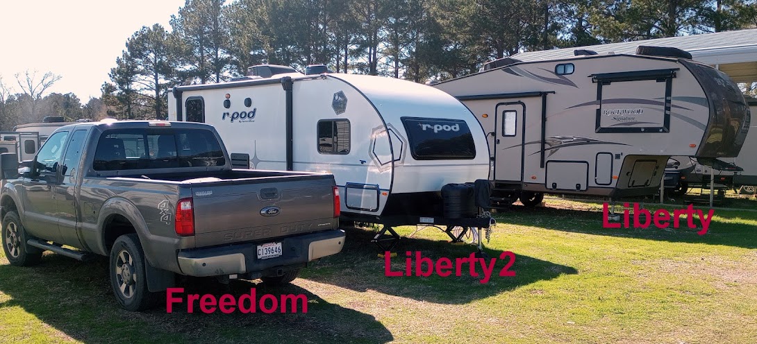
Sunday, April 5, 2015

Moving Day to Fort Stevens, Sea Lions and a Shipwreck

Location: Fort Stevens State Park (el. 25 ft); Hammond, Oregon

(click pictures to enlarge)
(all pictures taken with Nokia Lumia 929 Cell Phone)

Happy Easter

Yesterday was moving day and I moved up the Oregon coast as far as you can go before getting into Washington state. The total mileage was about 135 miles with about half of that length within site of the ocean and the other half inland. It was two completely different landscapes that changed back and forth as I drove. 
Crossing the Yaquina Bay Bridge for the last time as I leave South Beach

The Pacific Ocean can be distracting sometimes. It is a beautiful sight

The inland portion of the trip. Mostly dairy country.

The view from an overlook with a large enough pull-out for Freedom and Liberty. This is looking south

Looking out to sea. The clouds were cooperating today and looked great.

Looking north. I met a nice young couple from Canada that were planning to do some traveling in the future.

I caught the gull at the right spot with the bright clouds behind it

I'm camped in Fort Stevens State Park and will be here for 5 days. It is in the extreme northwest corner of Oregon and close to both the Pacific and the Columbia River. The fort was built in 1863 as a result of a boundary dispute between Britain and the U.S. It's main purpose, with two other forts across the river in Washington, was to guard the entrance to the Columbia River. A little more than 100 river miles upstream is Portland, Oregon which is a major port for the U.S. The fort was closed and abandoned in 1947.

Fort Stevens is also the only "military" installation located within the continental U.S. to come under fire during World War II. It happened on June 21, 1942 when a Japanese submarine surfaced and lobbed 17 rounds from their deck gun into the fort. There were no injuries and the only damage was to the backstop on the baseball diamond. I guess they didn't like baseball. The American gunners were not allowed to return fire for fear of giving away the position of their guns. I assume if more damage had been inflicted, we would have returned fire. This type of submarine event was not unprecedented. Earlier that same year, a submarine lobbed shells into an oil field near Santa Barbara, California. Remember, Doolittle's Raid over Tokyo was in April of 1942. Maybe these two submarine events was in retaliation of the raid. 


My campsite, tucked neatly under the pine trees.

After getting set up I went to see the remnants of the wreak of the Peter Iredale. It was 4 mast steel/wood sailing ship that ran aground, back in 1906, on the beach about a 1 or so from the campground. It was heading to the Columbia River and while waiting off shore for a pilot, it was hit by strong winds and current which pushed it ashore. The impact of hitting the beach was so strong it snapped 3 of the 4 masts. The life station to the north rescued all hands. After salvaging the cargo, the ship was left to deteriorate. It immediately became a tourist attraction and remains one today. 

The temperature was in the low 60's with a nippy breeze blowing. I used my windbreaker and was comfortable. There were very few people on the beach area.


The remnants of the wreck of the Peter Iredale from 1906

A little closer

The last view of the wreck

Looking south along the beach. Notice the headlands in the distance. 

It was about 3 hours after high tide. The little girl to the right was looking everywhere for treasures.

Just another view of the water

It was neat the way the waves were rolling in. It was in slow motion most of the time.

This woman was having a great time tempting the waves. She was laughing out loud and it made me smile.

I drove into the town of Astoria which is a moderately sized town on the banks of the Columbia River. I got a very nice smoked chicken plate lunch with "smoky potato salad" and cole slaw. After eating, I walked along the river bank for a while and found some sea lions taking a nap. Some were branded like cattle and I was puzzled. I googled it later and found the reason. Apparently some sea lions have been eating protected fish up-stream at the Bonneville Dam. The dam has a fish ladder for salmon and steelheads to be able to swim up and over the dam, but due to the number of fish and the size of the ladder, they must wait in line. The smart sea lions have learned they can catch the fish easily while they are hanging around in line. So, the government steps in. The government believes there are only some sea lions doing this, so they trap the ones doing it and brand them with a number. If they do it again, then they are hunted down and relocated or killed. I'm not sure how I feel about this yet. In the picture you can see some of the branded ones.  
The sea lions taking a nap. About every minute or so, a couple will set into to "barking" then go back to sleep. The bridge in the background goes to Washington state.

Seafaring cargo ships waiting to go upstream to Portland.

Before calling it a day and heading back to the campsite, I went to the tip of the campground. It is located at the south jetty that protects the mouth of the Columbia River. 


This is looking south along the coast. The rocks in the foreground is the jetty

Looking along the jetty out to sea

To the left of the jetty is the Pacific. To the right across the dirt is the entrance to the Columbia River.
It was a good day. 

Ya'll take care of each other. I'll Cya down the road.

Friday, April 3, 2015

Cape Foulweather, The Punchbowl, a Dog and a Bridge

Location: South Beach State Park (el 15 ft); South Beach, Oregon

(click pictures to enlarge)
(all pictures taken with Nokia Lumia 929 Cell Phone)

Happy Good Friday

I took a drive yesterday to see what I could see. I headed north because I wanted to see Cape Foulweather. I had heard of the place long ago when I read stories about Captain Cook's voyages in the Pacific Ocean. He named the point of basalt jutting out into the ocean, "Cape Foulweather", because after spotting the area, bad weather set upon his ship. His discovery was in 1778, just one year before his death at the hands of native Hawaiians in 1779. Captain Cook and his men saw this area 27 years before Lewis and Clark reached the Pacific in 1805. 


Looking out to sea from Cape Foulweather

This picture is looking south. The second point is the Punchbowl which is next on the list. The point in the distance is the Yaquina Lightstation. From this perspective you can see why they chose that location.

Just about every place now-a-days has some touch of commercialization associated with it. I've grown to accept it.

The next pictures are of the Punchbowl. It is an old sea cave whose roof has collapsed. Waves enter and fill the "punchbowl" with water during high tide. I was there just after high tide. It would have been better to have been there about an hour before high tide to see the waves crashing inside. 
The location is a very scenic viewpoint.

This is the Punchbowl. You can see the opening in the center. Waves were crashing in, but not as ferocious as I expected. It would have been better during the time approaching high tide.

The view from the Punchbowl overlook

More view from the Punchbowl. Those motels and houses sure have a nice view as well.

The top of the Punchbowl is to the right

Looking down at the beach area from the Punchbowl. A few surfers were out trying to catch a wave. The temperature was in the lower 50's so they were dedicated to their sport.

You can still see the surfers. Also in the distance is the Yaquina Lightstation

Just a bare, old tree.
I stopped for lunch at my favorite restaurant (T_ _ _ B _ _ _) and got a picture of this dog on my way out. The backpacks belong to his owner who was inside charging up his cell phone and using his tablet. I have seen several of these "walkers" along U.S. 101. 
The dog is catching a nap while his owner is inside.
On the way back to the campground I decided to get a sideways picture of the bridge over the Yaquina Bay between South Beach and Newport. The bridge is 80 years old. The lanes are a little narrow, but structurally, she looks pretty good. I didn't have the opportunity to do a proper hands-on inspection, but I trust the bridge inspectors with ODOT.

It's a pretty bridge uh? 
Tomorrow is moving day. A shower is passing over as I'm finishing up this post. The forecast for tomorrow is showers in the morning but the wind will be mild. I will take the rain over wind any day. I'll be heading north to Fort Stevens State Park near Astoria, Oregon. That will finish up the Oregon coast for me and I'm not sure which direction I'll be going when I leave there. 

Ya'll take care of each other. I'll Cya down the road.


Thursday, April 2, 2015

Yaquina Head Lighthouse and a Reuben Sandwich?

Location: South Beach State Park (el 15 ft); South Beach, Oregon

(click pictures to enlarge)
(all pictures taken with Nokia Lumia 929 Cell Phone)

Yesterdays exploration took me to Yaquina Head Lighthouse, located about 10 miles north of the campground. I seem to be attracted to lighthouses and will usually visit them if given the chance. To me, lighthouses are very special. It is like the old Motel commercial when the guy says, "we will leave the light on for you". It was the same for lighthouses and their keepers. It was the promise to the fishermen and merchant marines that the light would stay lit so they could find their way home or warn them about hidden dangers. You can imagine how it must have been a hundred years ago before Radar or Radio. On a dark, starless night as your sailing ship slips quietly through the emptiness, you see a flash of light, then it's gone. Time slows down as you wait for it again. The seconds seem like minutes and your mind begins to wonder if it was real or imaginary, then "bam" it flashes again. It is like a lifeline that has been thrown to you to help you get to shore or to pass safely through treacherous waters. The reason the sailors could see the light was due to the dedication of lighthouse keepers. Back in those days, the light was from burning oil, usually whale oil. The keepers had to keep the light burning through every type of storm. It will never be known how many lives they saved. I have seen lighthouse lights from the sea when I was in the Navy. We, of course, had Radar to guide us and tell us where the dangers were located. But, even with all the electronic gadgets helping us, it was a very good feeling to know that the lighthouse was there and we could see it. It represented life on the other end of that light. And it was good.

Yaquina Head Lightstation was built in the early 1870's and is the tallest lighthouse in Oregon. The lighthouse was brought into service on August 20, 1873 when the first light was lit. Its light can be seen 20 miles away. It became automated (no lighthouse keeper) in 1966. A "lightstation" is the lighthouse and all the associated buildings on the grounds used to maintain the lighthouse. The Yaquina Head Lightstation is built on a spit of land jutting about a mile into the ocean. The land consists mainly of basalt that was laid down by lava flows from an ancient volcano that erupted 14 million years ago. Well,,,,, I'm not sure about the 14 million year information but that is what they said in the brochure. It is hard for me to believe anything, including basalt, will resist the ravages of nature for that length of time. But I'm sure they have some kind of fancy data that they say "confirms" that time period. Oh well, to each their own.

I didn't realize it until I got to the entry booth where you pay the fees, but my America The Beautiful Pass that I bought back at Sequoia National Park would get me in free. The pass cost $80.00 and I've now saved about $20.00 and I have 11 more months to go before it expires. 

I was told of a restaurant that had the best Reuben sandwiches in Oregon. I can not pass up the possibility of getting a great Reuben because the great ones are few and far between. The place was called Nana's Irish Pub. My first thought was; a Reuben sandwich is not Irish food, but I gave it a shot. I told the waitress what I had heard about their Reubens and she said yes they were the best then started in on trying to get me to order a Guinness beer. With the memories of the amount of beer consumed in the 70's, I passed on the beer and opted for just water. For a while I couldn't find it on their menu but then I saw it listed as a "Bunratty Reuben". I should have got up and left then, but I was hungry so I ordered it. Without being too critical, I will attest to the fact that the Rye bread was very good. The corned beef was about 3/8 of inch thick and I could barely taste the swiss cheese. There was cabbage leaves instead of sauerkraut and no dressing at all. I ate it, but it was definitely not a Reuben sandwich. The search continues.

The good thing about visiting lighthouses is their location. They are usually located in areas with fantastic views of the waters. 
The road leading to the lighthouse. The lighthouse keepers home and other buildings were destroyed many years ago and never rebuilt.


The walkway up to the lighthouse. Psst, there is a bench along the path too :)

A place where softer material has eroded away creating this little cove

A view to the north

A slightly different view

A "washing machine" area

The view south

The beach area to the south of the lightstation

The view out to sea from the edge of the road

I included part of Freedom to add some change from the water views

This squirrel was waiting on me at my campsite when I got back. It looked wet and cold. I think he was trying to dry and warm himself in the sun.
Ya'll take care of each other. I'll Cya down the road.

Wednesday, April 1, 2015

Moving Day to South Beach State Park

Location: South Beach State Park (el 15 ft); South Beach, Oregon

(click pictures to enlarge)
(all pictures taken with Nokia Lumia 929 Cell Phone)

I moved campgrounds day before yesterday (Monday) so I'm a little behind on posting. Bullards Campground emptied out pretty quickly on Sunday. Spring break was over and all the kids were due back in school. By mid afternoon the park went from being full to only about a dozen of us travelers. As I walked around the nearly empty park, I looked inside a Yurt. A Yurt is like an Indian teepee but has a domed roof. The state parks in Oregon have several yurts they rent out to people without RV's or tents. They seem to be very popular.  

A Yurt. The covering is a heavy canvass/plastic with a plastic domed skylight at the top. Each site comes with the porch, picnic table and fire ring.

Looking inside the Yurt has a bunkbed (larger bed on bottom), a couch and to the left out of the picture is a table and chairs. In the back is a window and heater.

I hitched up Monday with only a short tow of about 100 miles to the next campground. Before leaving, I decided to try something I bought last year. It has been traveling around in my storage compartment and I wasn't even sure if it would work. I put it in storage and somewhat forgot about it. It is called a Trailer Aid and is used to change tires on a twin axle trailer without using a jack. I had a tire changed last year when I was camped outside of Washington D.C. and used my roadside assistance plan. The guys showed up and used a hydraulic jack to get the tire off. I didn't like that and dreaded the thought of having to do that on the side of the road in whatever dirt the shoulder of the road may have in place. I had heard about the Trailer Aid but never was able to find one in the stores so I ordered it from Walmart and picked it up before Thanksgiving. It worked like a charm and did exactly what it was suppose to do. The other tire is lifted about 1 1/2 inches off the ground just by driving up the ramp. It is a comforting feeling knowing I have that with me and I'll use it even if the roadside people change the tire.  
The Trailer Aid worked very good. It raised the back tire by about 1 1/2 inches off the ground. The stacks of leveling blocks in front of the ramp is not part of the Trailer Aid. I put my blocks there in case I drove off the ramp. Since I travel solo, I don't have a whoa'er (person hollering "whoa"), so I needed some insurance about overrunning the ramp.


This was a surprise. I've stayed in dozens of state parks around the country but have never seen a "Dump Station Donations" box at the dump station. I assume it is for people that dump their tanks but are not staying in the park. 

There are several bridges like this on Highway 101. I got lucky and was stopped by a road crew so I could take this picture. "Top Arch" bridges constructed of concrete are not very common. I also like the decorative columns.

This is one of those spots where you pop out of the woods and see the ocean. Each and every one is always a "wow" moment for me, and yes, I say "wow" out loud. 

My plan was to stay at Beachside State Park for 5 days. When I got there and drove to my campsite, it was painfully obvious that Liberty was too tall to fit. There were several tree limbs about 10 feet off the ground and right over the campsite. Looking around at the other campsite, most were in the same condition. Liberty tops out at 12 1/2 feet high so I just turned around an went back to the office. They refunded my money and I pulled out and headed north to another state park that I had looked at but rejected in favor of Beachside. It was only about 15 miles north so I headed that way to see what they had to offer. Serendipity struck again and this park, South Beach State Park, is more open, closer to a city, better cell signal, prettier, cleaner, etc, etc. Everything happens for a reason. I guess I'll find out why I'm here eventually. 

Campsite in South Beach State Park. Notice this park is almost empty as well. I would guess it is about 20% filled. 

The ocean is about 1/2 mile away from the campground with a couple paths leading to the beach. After getting set up, I took a walk to see the beach. 
The path starts out as a hard surface through the woods


The trees are mostly covered in moss. I'm not sure if this is what is called, "old man's beard". I'm still checking on that.

The path comes out of the woods and into a sand dunes area covered in grass.

Along the way, I found a "thinking bench". It overlooks the grassland and trees. In the distant background is the bridge leading to Newport. Notice the bumblebee in the upper left corner. I didn't notice him until I downloaded the picture.

The hard surface path ends and the sand path begins as you get closer to the sand dunes.

The view as you top out on the dunes. 

Looking north. Those jetties are protecting and outlining the Yaquina River.

Looking south. Cloudy day with patchy rain
Looking back in the direction of the campground
I'll be here for 5 days before moving farther north. The weather has taken a turn for the worse with daytime highs predicted to be in the low to mid 50's and nighttime lows in the lower 40's. Rain is coming in waves about every 2 hours but so far none have been strong thunderstorms. If the wind picks up, we are well protected by the sand dunes and trees between us and the ocean. My ceramic heaters are keeping it about 65 degrees inside Liberty. It is a little nippy but a really good sleeping temperature. I'm having to be careful about keeping the two heaters on low so I don't trip a breaker since I am on 30 amp service.

I'll be doing some exploring in between the rains.  

Ya'll take care of each other. I'll Cya down the road.