Friday, December 8, 2023

Marshes and the Gulf of Mexico

 Location: Intracoastal (ICW) Waterway Park; Hackberry, Louisiana

Today is day 3 of 3 and tomorrow is moving day. It is very overcast with high chances of rain today and tomorrow. Yesterday was the exploration day and it was much better, weather-wise. Exploration was easily accomplished by driving around in Freedom and stopping every now and then. As I said in my last post, most of the land south of the ICW is either marsh or swamp. Since I'm camped on the banks of the ICW, it doesn't take long to see the marshes. There are many different kinds of marshes, but since I don't know what they are, I'll just call anything south of me a marsh. That is until I get to the Gulf of Mexico which is only about 25 miles away. The conditions around here are ripe for lots of mosquitoes which will attack you in force when you get out of your vehicle. I found that I had about 1 minute to take pictures after rolling my window down before the skeeter scouts found me. I have some OFF in Freedom but I have never liked using it so I've mainly been roughing it, commando style. So far, so good. (Note: as I'm proofreading this post, the Parish is spraying the campground for skeeters. I'll see how effective they are tomorrow when I'm hitching up)

I think it will be easier to just post pictures with detailed captions.

Before I get into the pictures, if you like watching tow boats and barges while they work, this is the campground for you. There are at least a couple dozen that pass my campsite every day. I didn't think I would get his way, but I'm getting to be Ho-um about them. The lift bridge has only had to be raised once since I've been here and it was due to an oversized load that had both a tug boat and a tow boat. That may confuse people, but the main difference between the two boats is a tug boat pulls its load while a tow boat pushes its load. That's not always the case because I have see tug boats push ships around in port back in my Navy days. If I can post the video I took, you can see the difference. 

On with the pictures:

Location Map.

Two things in this picture. I couldn't tell as I went by but chances are those two people are crabbing and not fishing. The object in the background is an oil pump that is pumping oil out of the ground and directly into a pipeline. To the people that complain about pipelines, would you rather have a large storage tank set up near the pump with 18-wheelers coming daily to haul it to the refinery or what you see here. But it really isn't about the piplelines with them, is it? It's about doing away with ALL of the pumps and wells. (jumping off soapbox now).  

What the heck? That's an ocean going ship in the middle of the marsh!! Calm down Goza, it's not in the marsh. It's sailing on the Calcasieu Ship Channel which connects the Gulf of Mexico to Lake Charles, Louisiana. Lake Charles is the 11th largest seaport in the country and is 30 miles from the Gulf.  

The ship channel also allows these shrimp boats, and many more, to get into the Gulf of Mexico. Near the boats are places where you can buy the shrimp directly off the boats. Next time you're shopping for shrimp in the stores, look on the package to see where they are from. Way too many are from China and Indonesia. If it says "Gulf caught", you can bet they are generally real fresh. Someone slid that soapbox back under me. 

Long lonesome highway!! The marshes are a lot like the desert southwest or western Texas. And like the deserts, you either like them or hate them. I'm a little to the "hate" side of neutral on both. I can take 'em or leave 'em.

See that area in the distance on the left. In Louisiana, those are called "islands". They aren't real islands, but they are safe places in the "sea of marches". This island is call Hog Island.  

This the typical canal that runs alongside the roadway. Every now and then you get a bridge that crosses it to get to a recreation area. This type of canal has been cut throughout the marshes and swamps of Louisiana by the oil and gas industry to gain access to wells etc. Some people say the canals hurt the area because it allows storms an avenue to cause erosion and damage. Yep, that is probably true, but on a scale so small as to be acceptable when compared to the benefits the people get from the oil/gas industry. It's all a balance. Someone please hide this soapbox before I hurt myself.

Nothing controversial about this location. It is just a marker from the scenic trail that runs in this area. I thought it was a neat picture. There are lots of hiking trails around here.

With all of the canals in the marshes, there has to be a means to control some of the flow, which these weir-like structures provide. 

This is obviously the Gulf of Mexico. The two dots on the horizon are oil/gas offshore platforms. Those are what some people in the northeast part of the country don't want offshore of their states. They don't look that bad. They could use some lights for decoration though.
The black structure is a rip-rap (pile of rock) dike/jetty. They are used to create sand beaches. I remember this being discussed many years ago and lots of engineers gave their input. I was curious to see how they were doing. They definitely have created some beach and stopped erosion. So it was successful and the only question is was it successful enough to justify the cost. I'm out of the business, so I don't have the contacts anymore that could provide me honest data. Well, I guess I could, but I'm not interested enough to spend that much time. 

This is the state road that parallels the Gulf. You can get an idea how many of those rip-rap structures are out there. They go on for miles and miles. If I remember correctly, the state was concerned about the Gulf washing this road away but now the rip-rap has saved the day. Texas could have used them to save the road between High Island and Port Arthur which they abandoned many years ago because of beach erosion taking out the road. They are now battling the problem from High Island towards Galveston. 

Some beach created at a small beach house community.

These are residences in the small beach house community from the previous picture. I turned away from the Gulf to take this picture. I'll take the house on the right. Obviously, there aren't any zoning laws. 

This is the Cameron Ferry. It is one of three in the state. It crosses the Calcasieu River, which is also the Calcasieu Ship Channel. It isn't free like the ferries in Texas, but it is still very cheap. The cost is $1.00 per vehicle if you're going west-bound and free if you're going east-bound. 

This "snakey" bridge goes over the ICW to the east of where I'm camped. If you're wondering why it has such curves, it is because the old lift bridge was to the right of the new bridge and traffic had to be maintained on the old road while the new bridge was built. 

That's the "snaky" bridge to the left where the boat has sunk. It looks like it has been there for a while. Freedom is sitting on the old road that used to cross the ICW.

Great view of the area while crossing the "snaky" bridge.

How is this for serendipity? While checking out the underside of the "snaky" bridge, this sail boat came motoring up the ICW. I didn't see anyone onboard so I guess it could have been a ghost boat, but I'm not close enough to New Orleans for that so they must have been steering from inside. Probably inside to get away from the skeeters.

This is the only time the lift bridge has been lifted since I've been here. This is the load that was pulled and pushed. I'll try to embed the video after this picture. Fingers crossed.


Blogger put the video at the bottom of the post. I ain't gonna try to move it. 


From my campsite, the sun sets under the bridge as I'm looking out my door. The sunsets haven't been great, but on this evening, the clouds made up for it with their own show.

Tomorrow is moving day and I'll be heading east to a State Park just south of Abbeville. It should be a nice easy tow with a Walmart stop on the way. 


Ya'll take care of each other. Maybe I'll Cya down the road.  

Wednesday, December 6, 2023

ICW Campground

Location: Intracoastal RV Park; Hackberry, Louisiana

Today's tow was about 165 miles of mostly 4 lane highway. Parts of it was very rough and some things inside Liberty that usually ride in place got thrown around. I'm ashamed of some of the state/federal highways in Louisiana. The sad part of it is that it wouldn't be in this condition if routine maintenance had been performed over the several years as it has been for decades and decades in the past. And news flash,,,,, it's gonna get a lot worse before it gets better. Jumping down from my soapbox now. 

This campground is owned and run by the Calcasieu Parish Police Jury. Those four words are going to cause some readers to go,,,,"uh?" First, Calcasieu is pronounced Kal-kuh-shoe. Second, in Louisiana, Parish is the same thing as county everywhere else in the country. Third, in Louisiana, Police Jury is the same as County Commissioners, etc in most other states. 

It is a nice little campground on the banks of the ICW which is great for tow boat and barge watching and at the daily rate of only $12.00 per night. It should work great for me as a base camp so I can explore the beaches and marshes in the areas south of here. I'm curious to see how a rip-rap project on the Gulf coast is doing. It was suppose to stop some beach erosion and possibly restore some of it.

I'll also be checking out Rutherford Beach as a possible campsite on my return trip later this month.

The campsite with the ICW in the background.


This was taken from the bridge over the ICW. The state was working on the bridge deck so it was one lane traffic. It worked good at taking the picture. The campground is the area in the center-right of the picture. There seems to be an extraordinary amount of barges and tugs tied up early in the day. 

Just as it was at many of my campsites I stayed at this summer, working tow boats and barges are on parade here too.

I'll be packing a lunch for tomorrows exploration and I hope it is a good weather day to enjoy it while looking out to the Gulf of Mexico. I was even extra good when I stopped at Walmart on my way down here. I picked up some Turkey and Ham for my sandwiches. I could hear the bologna saying "buy me, buy me" but I resisted. 

Ya'll take care of each other. Maybe I'll Cya down the road.   

Tuesday, December 5, 2023

South Louisiana Trip begins Tomorrow

 Location: Heart of Haynesville RV Park; Mansfield, Louisiana

This post will be a short one and used to document the beginning of my next trip. Some of my memory demons have been catching up to me lately so I guess it is time to travel and try to outrun them. When I'm traveling, they have a hard time finding room to play in my head since I'm usually seeing lots of new things that takes up a lot of the empty space up there. I guess it's true,,,,,,"Idle minds are the ,,,,,,,,,".

My trip to the marshes/swamps of South Louisiana begins tomorrow. I guess it is important to know the difference between marshes and swamps. To me, swamps are wetlands with trees and marshes are wetlands without or only a few trees. You can also think of marshes as "wet deserts". That will become clearer once I post some pictures. 

A general rule of thumb in Louisiana is that all of the areas south of the Intracoastal Waterway (ICW) are marshes. For those that aren't familiar with the ICW, it is a 3,000 mile water route between Boston, Massachusetts and Brownsville, Texas. It roughly parallels the Atlantic and Gulf coasts. It's purpose is to provide an inland waterway to transport goods around the country without having to get in the open ocean. Think of it as a man-made river full of barge traffic. It was built and is maintained by the U.S. Army Corps of Engineers. It is one of the major infrastructures in the country and usually overlooked.

The Green Line is Interstate 10 which crosses Louisiana east-west. The Purple Line is the Intracoastal Waterway (ICW). A good rule of thumb is anything south of the ICW is either a marsh or swamp. 

Tomorrow's tow will be about 160 miles on mainly 4-lane divided highways. My first campground will be located on the banks of the ICW, so I should get some good views of the barge traffic when I'm in the campground. The campground will be used to explore the marshes/wetlands in southwest Louisiana south of the ICW. 

Ya'll take care of each other. Maybe I'll Cya down the road.

Sunday, November 26, 2023

Let's Explore Southern Louisiana (swamps and all)

 Location: Heart of Haynesville RV Park; Mansfield, Louisiana

I've been home about 6 weeks now and since Thanksgiving is over, I've decided to take a short trip before Christmas gets here. I can't leave until after December 4th since that is Grandparents Day at my granddaughters school. So the trip will begin on December 6th and last until about December 22nd. It will be about 900 miles long with 6 campgrounds along the way. Several readers of the blog have asked about Louisiana so I've decided to show off the extreme southern part of the state. Most of the parts will be new locations for me as well and I look forward to visiting them. "Going places I've never been before" has always been good advice. Although I've done it a few times over the years, I don't like revisiting the same places since there are so many new places yet to see.  

I have the trip pretty much mapped out with reservations at the first 3 campgrounds. The 4th and 5th campground are first come, first served, so I will be anxious about not having a reservation for those two. I haven't decided on the 6th and final campground yet. I'll be staying 2 to 3 days at each of the campgrounds. 

I won't be exploring New Orleans during this trip since I've been there before and wrote about it in this blog. If you want to read about that exploration, you can search for it in the search bar. This trip will be exploring the swamp and wetlands of deep south Louisiana. It will also include going to the farthest south you can go in a vehicle in Louisiana which is near the mouth of the Mississippi River. Since I explored its source in Minnesota years ago, it will be another one of Life's Circles. (another blog post to search). Five of the 6 campgrounds will be south of Interstate 10. I-10 enters Louisiana from Texas after passing through Beaumont. It then heads east to Baton Rouge and New Orleans before leaving Louisiana and enters Mississippi. On its way across the state it passes through the heart of Cajun Country before crossing over the Atchafalaya Swamp and Mississippi River.

The route is in red and Interstate 10 is in green. Generally everything south of I-10 is swampy wetlands. Well will see.
 
This is a short list of words to help some of my Yankee readers with the pronunciation. 

It should be an interesting trip and may highlight parts of Louisiana that people haven't seen. It will also show that trips don't have be months long or cover multiple states. With 2 to 3 day stays at the campgrounds I shouldn't feel rushed or in a hurry. Some RV'ers now-a-days feel they have to travel great distances to get somewhere quickly by driving several hundred miles per day and several days back to back with only overnight stays along the way. I can understand that for people on vacation who need to get some place quickly before having to return to work. Full-time travelers and retirees should not have to "ball the jack" like that when traveling. They should remember; it's the journeys along the way, not so much the final destination. But, as a full-time RV'er (may she RIP) taught me years ago, everyone travels and explores in their own way. 

I'll finish out this post with some picture. My campsite is located pretty good where I can see the sunset from the door of Liberty. Since they are self-explanatory, I'll post the pictures without captions.


Ya'll take care of each other. Maybe, I'll Cya down the road.   


Tuesday, October 17, 2023

Trip Wrap-up

 Location: Heart of Haynesville RV Park; Mansfield, Louisiana

To get the boring statistics out of the way, here they are:

The trip started on June 11, 2023 and ended on October 10, 2023 during which I towed Liberty about 4,200 miles while camping in 32 different campgrounds (14-state parks, 13-COE, 2-Tennessee Valley Authority, 2-County, 1- private) in 10 states. The cost of campgrounds was about $2,700.00 (average = $22.13 per night) while the cost of fuel was about $2,400.00. I'm disappointed in the amount of State Parks in comparison to COE's. COE's remain my preferred campground with State Parks and County Parks coming in a distant second.
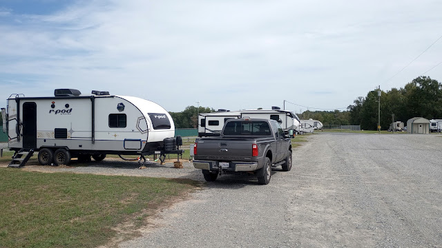


My campsite for the next 2 to 3 months.


This old barn is in the cow pasture behind my campsite. It appears to be ready to fall in at any time. I hope I remember to take a picture of it before I leave in a couple of months to see how it is doing. 

There were several reasons for the trip other than the general reason of getting away to "see what I could see while the seeing is good." The large Forest River RV Rally in Goshen, Indiana was the long range destination, but as usual, the journey to get there was not even close to being the most direct route. As Malia Lane (RIP), solo RV'er, use to say in her blog, ",,,,the journey never ends." 

Along the way: 

I explored and learned about the Tennessee River Valley and the hydroelectric dams which transformed it the entire valley into something special. It is one of the most successful programs of FDR's New Deal and is still paying great dividends today and will continue to do so into the distant future.  I remember learning a little bit about it in school but nothing as in depth as traveling, camping and exploring along the river. I sure hope the schools are still teaching about it.

I explored and learned about the Battle of Shiloh/Corinth and the minor battles leading up to it. It was a turning point in the war and dealt a crippling blow to the south in terms of transporting materials and troops. This is not my first Civil War battlefield. I've explored the beginning point at Fort Sumter, South Carolina and the last at Appomattox Court House, Virginia and several others in between. But it was during the exploration at Shiloh where I got a better understanding as to why Southern Monuments in the cities of the south were erected after the war. They serve more as an all-encompassing general headstone to the southern soldiers who died during the war and never returned home. The vast majority of the monuments were erected because family members didn't know where their loved ones died and were buried. If their loved ones died at Shiloh, more than likely, they lay on the battlefield for weeks until all of the Yankee soldiers were properly buried in a cemetery with their names recorded, if known. After which, the Yankees took over from the local citizens who were burying the Southern dead. The Yankees made quick and disrespectful work of it by burying the Rebels in mass trenches on the battlefield. When the family members learned of this, from Shiloh and many other battles, they erected Memorials to their lost loved ones. Often-times they were erected in the heart of their cities near the court house and served as a Mass Headstone of the deceased Southern soldiers. These are the Memorials that are now being removed by stupid people, encouraged by some politicians and ignored or incorrectly reported on by the media. Sad times being created by people who don't know their history or maybe they do and are just ignoring it. 

I visited several Indian Mounds on this trip. And as with the Civil War battlefields, these were not my first or biggest. To my surprise, I finally got a good answer, it many not be the correct one, to my question that I always ask when visiting these Indian Mounds. "Why would people, who had to struggle each day just to survive, waste time building a large pile of dirt." The good answer was, they marked the annual or bi-annual meeting places of different tribes in the area. The various tribes would meet to trade items and information, choose wives and husbands and maybe a little partying. To mark the spot for next year, and sanctify it, they would build an earthen mound, little by little, year by year. That makes more sense than some of the other answers I have gotten over the years from the "experts". This answer does not apply to places like Cahokia, near St. Louis, since it was a giant city, not a gathering spot.

The Forest River Rally was a nice mid-point on the trip. I met lots of new people and talked with many of the technicians about maintaining/repairing RV's. If you are an RV'er and think your RV will survive the brutal roadways in our country without the need for preventative maintenance and repair, then you shouldn't be RV'ing. I will probably go back next year if, as my mother (RIP) would say,,,,,"if the Lord's willing and the creek don't rise." 

I saw some really good sunsets/sunrises, many lakes, rivers, working tow boats, lots of dams, some good museums and a few nice scenic drives. I saw lots and lots of farmland with crops growing high and healthy. There were many clean and vibrant small towns supporting those farmers. I had a few really good and unexpected meals at restaurants while eating out. Some even came close to Taco Bell. I was pleasantly surprised by some other campers who brought me supper three nights in a row. I'm still in the process of convincing myself that it was not only due to their generous nature but also because I looked so scrawny and skinny as to have people believe I'm starving to death. I have taken to carrying rocks in my pockets to weigh me down in case a strong gust of wind blows up. 

Freedom and Liberty (I've quit using Liberty2) performed very good with the only problem being Liberty's air conditioner going out. It was replaced in a relatively short period of time and under warranty, so that "problem" turned into and "adventure". Adapt and overcome. 

The trip was a success and I missed the majority of the record setting heat of a Louisiana summer. I should be here through at least Christmas. I have a feeling a very cold winter is in store for Louisiana to go along with the very hot summer. We seem to be in that pattern. Unless something prevents me from do so, I plan to spend the winter somewhere with highs in the 60's and lows in the 40's.

It will take me some more time to organize and post some pictures from the trip. If you can wait that long, they are in all of the posts that I made during the trip.     

Ya'll take care of each other. Maybe I'll Cya down the road.


Tuesday, October 10, 2023

The Last Leg of the Trip

 Location: Chicot State Park; Ville Platte, Louisiana

This will be a brief post and will basically serve as a page mark to document the last campground before getting back to my home base for the holidays. 

This campground is a old state park along I-49 in the middle part of the state. I chose it simply because of its location in relation to my sisters hometown of Youngsville, Louisiana which is just south of Lafayette. It was an easy day trip yesterday to visit with her and get caught up on things. It was a nice visit. 

It's a nice isolated, in-the-woods campsite.

I got here Sunday afternoon after passing over the worse roads during my entire trip. I will not come back to this campground until they repave the state roads leading to the park. And of course that means I'll never be back since I doubt they repave them in my lifetime. 

If you're looking for a quiet, back in the woods type of campground, this is for you. I didn't do any exploring around the area during my stay of two days. If I had stayed longer, I wouldn't want to do much exploring because I would have to travel over the bad roads too much. 

Today is moving day and the last leg before getting home. It will be about 150 miles to get there with a stop along the way. I'm thinking about stopping at the CAT scale I used at the beginning of this trip. It may be interesting to see how much weight Liberty has gained or lost. I'm having to change my home base campground from the one I've been staying at for the last few years. I knew the owner, who lives in Houston, had been talking about closing the campground down and I guess he did it while I was gone on this trip. When I called, the voice message was a little vague but when I checked online it showed the campground as permanently close. 

Oh well, I'll just go to another one near Mansfield. I've stayed there a couple of time several years ago. The campground has about 150 campsites but was nearly full when I left so I was a little concerned that it may still be full since they would be absorbing the campers from the closed campground. When I called the new campground, the owner told me he had about 100 vacancies and for me to just pick one, set up, then Venmo him the information and rent. Sounds pretty easy if I can just remember how to do that Venmo thing.

I still have to do the trip wrap-up but it will have to wait a few more days so I can de-compress some more and get my thoughts in line. 

Ya'll take care of each other. Maybe I'll Cya down the road. 

Sunday, October 8, 2023

Nearing The End

 Location: Natchez State Park; Natchez, Mississippi

It was another long haul to get to this campground but I did it intentionally. I wanted time for some "thinking driving" before ending my trip next week. It was a nice drive but I still have more thinking to do. When moving campgrounds as quickly as I have been doing, it take a little while for time and events to catch up with you once you stop. That is what I was hoping for at this campground. My plans were to do only a little exploring and use the rest of the time to get my thoughts and feelings in order. Today is day 4 of 4 and I guess 4 days weren't enough time. I'll have to wait for a future post to do a wrap-up of this trip. 

Nice campsite but a strange campground. There isn't a check-in booth as you enter the campground. The rangers station/check-in is all the way at the end of the park. Strangers or "ner-do-wells" (old term) can enter without any concern. When I got here, there was only one other camper in this loop. 

This is the lake in the park. I assumed it had been created maybe back in the 50's or earlier, but the Ranger said it was done in the 80's. I haven't checked that to confirm though.

Natchez is an old town located right on the Mississippi River. You would think it played an important role in the War for Southern Independence but you would only be partially correct. At the time of the war, Natchez was one of the wealthiest cities in the south due to the excellent farm lands and proximity to the river. The rich people outfitted several companies of Rebels before sending them north to fight. I guess the south didn't see the need to defend Natchez since the Yankees took it easily after capturing New Orleans and Baton Rouge. It didn't play a significant role in the war after that.

If you've seen the John Wayne movie El Dorado then maybe you remember one of the characters played my James Caan. His name in the movie was Mississippi and he mentions a place called "Natchez Under the Hill". Well this is the hill you go down to one of the places with that name. There is a small casino down there now.

This is the other place that could go by the same name of Natchez Under the Hill or Natchez Under the Bluff. There are a couple of juke joints down there now.

One of the main reason I came here was to see an old riverboat that had been abandoned on the Louisiana side of the river. I found it by accident more than 10 years ago and was interested in seeing how it looked after that time. I was very disappointed to find that it had been salvaged and removed. Oh well, things are always changing. It was a nice drive anyhow.

The following pictures are from the Louisiana side of river. This is a picture of a typical river levee that runs the entire length of the river in Louisiana. I'm parked on the top of the levee and that is a paved state highway running along it's base. Louisiana is different than some of the other states with rivers in that you can't see the river from most of the roads because the view is blocked by the levee.

What a difference from the Mississippi side of the river with it bluffs compared to this flat open land on the Louisiana side. The reason, from what I've read, is because the bluffs were formed during the last ice age from nearly continuous duststorms blowing topsoil in from the mid-west. It was deposited on the east side of the river.

I've asked this question many times throughout this blog. What is the story behind not cutting this tree down? There has to be a sentimental/emotional reason because it doesn't make sense to plow/plant around it each year.

Same question about is tree. This one is at least alive and could be used as a shade tree during the summer while working in the fields. I didn't stop and ask anyone this time. Maybe next time.

A tree tunnel. These trees are maybe a hundred years old and were probably planted in front of an old plantation. 
 

On the way back to the campground, I stopped at the National Cemetery in Natchez to pay my respects to the "ones who came before". It's a nice cemetery with a good vibe.


Remember, the small square markers are the old ones and have only a number on them. They mark the old "unknowns". 

Today is moving day and my next campground will be in central Louisiana. I'll be there for only 2 days while I visit some family in South Louisiana. I should be back at my home town on Tuesday.

Ya'll take care of each other. Maybe, I'll Cya down the road.