Monday, July 17, 2023

Bad Campground JuJu In Kentucky

 Location: Bailey's Point Campground (COE); near Bowling Green, Kentucky.

Before leaving the campground in Tennessee, I received an email reminding me about my reservation at my current campground. I like those reminders because it gives me my campsite number so I can write it down on my driving directions. It also gives the check-in/check-out times. I thought it was a mistake at first because it listed the check-in time as being 5:00 pm. That is very late compared to the many COE's I've camped at over the years. This could be a problem since my travel time was only a couple hours with stops along the way. I waited as long as I could before I hitched up and left. I still arrived at this campground about 3:00 but they checked me in and off I went to find my campsite, oblivious to the adventure ahead. 

One lesson I've learned over the years is to check out a campsite before unhitching. If possible, do that before even backing into a site. By walking into the site you can get a better sense on how you're going to back in. It is also important to see where the electrical and water are located in the site. Well, this campground has lots of narrow, winding one lane roads to most of the campsites. This campground is also very large and filled to the brim. I knew I wouldn't be able to stop in the road long enough to check out the site without blocking traffic, so I quickly backed in knowing I could jockey around to find a good spot. Once I backed in, I got out to look the site over. Relatively level, both fore and aft, Check. Nothing to hurt the tires (lots of nails found over the years), Check. Room to move around to find the best location. Check. Any places where a mud puddle will form after a rain. Check. Any overhead problems? yep, I saw Bois d'Arc (Bodock) apples on the ground. Those could put a hurting on Liberty if they fell from way high up. I think some Yankees call them Horse Apples. Not ideal, but should be OK since no major storms were predicted. Electrical pedestal located in a strange place, but close enough. Check. Water location? Wait, where the heck is the water. When I made reservations, it said water and electricity available. I looked around at other RV's and they were using 100 plus feet of water hose to reach their rig. I didn't see a water spigot within 200 feet. I carry two 25 foot hoses for use every day plus a brand new 25 foot one in storage. Even using every hose I had, I couldn't reach the spigot, so I went back to the office to see where the fresh water fill sites were located. I passed the dump station and looked there since some campgrounds put potable water near, but not too near, there. Nope, not there.

I asked the guy in the office but he said he was new and didn't know. We looked at the campground map and noticed locations of water spigots scattered around the campground, mostly way off the roads. I made a U-turn and went in search of one that was located in a place where I wouldn't block traffic and still be close enough to fill my fresh water tank. After getting water, I went back to the campsite and backed in as easy as the first time. They designed the angle just right. Since I had already scouted the campsite, I started setting up. Then I noticed the water spigot about 100 feet away. I had missed it on my first scouting mission. I've since convinced myself that I would have been just a little short, maybe a few inches, of reaching that newly discovered, (possibly newly installed while I went to the office) water spigot. Oh well, no harm, no foul.

I continued setting up by plugging into the electrical. Ut oh, the insulation near the male end of the cord had come loose from the plug, not burnt, just loose. Bare wires weren't exposed but the internal paper insulation was showing. I hadn't noticed any problem when I stored the cord after breaking down the last campsite. Hmmmm,,,, It looked safe enough and I had already turned the power on before noticing the insulation so I told myself, it would be OK until I could get a new cord or plug on Monday. Well, today is Monday and the cord has done fine but I will be making a trip to get a new cord today. If one is in stock, I'll get a brand new complete cord since I've had minor problems with the female end as well. I figure the dealer supplied the cheapest cord possible and needs replacing. I'll put new plugs on this old one and use it as a back up. After doing some internet checking, the best location is a Camping World in Bowling Green. To help make the trip worthwhile, I'll combine it with a trip to Walmart to get a prescription filled. They probably have a Taco Bell in a city that size. I hope I can get in without having a reservation. A few pictures, with captions, from around the area.

The obligatory road picture showing the sky.

It's a couple of miles of narrow road getting to the campground. Corn is growing close by. I saw a field of a short crop but I'm not sure what it is and couldn't find anyone to ask. I didn't get a picture but if I remember I'll get on today.

A campsite cut into the side of the hill. Easy in and out. If you look at the middle right of the picture you can see the water spigot with its "cloak of invisibility".

The view out my back window while sitting at my computer work station. Hmmmm, I need to think of a retirement term instead of "work station".

I checked out one of the many boat ramps at this lake. 

Of course I had to check out the dam. Sadly, it's not hydro. People were fishing, maybe snagging, at the outlet end. I didn't see anyone catch anything though. Notice the RV passing over the dam. I hope they are going places they've never been before.

A view from the top of the dam. That is a smaller campground to the left of the spillway. I drove through it and would prefer it over the bad JuJu one I'm at now, but I could only get a very weak cell signal down in the bowl. A strong cell signal has moved up higher on my list of things I want/need.

A narrow state highway that circles around the lake.

I think I'll call this the typical picture of Central Kentucky, or it's at least what I'll remember it as being.

This campground stay is only for three days and tomorrow is moving day. It will be a very short tow of less than an hour and will be a campground on this same lake. I drove by and checked it out after receiving a mixed bag of reviews. It will be fine and I got a good vibe when driving through. The only potential problem is it has the same 5:00 pm check in time. I may kill some time by taking a short detour into a bigger city down the road to get some groceries before going to the campground. If the campsite is still occupied when I get there, I'll go park at the boat ramp and wait.  

Ya'll take care of each other. Maybe I'll Cya down the road.   

Friday, July 14, 2023

Exploring Middle Tennessee

 Location: Longbranch Campground; near Lancaster, Tennessee (about 30 miles east of Nashville)

It feels good being back in a basic Corps of Engineers (COE) campground. What a difference from the last three weeks of TVA, County and State Parks. For those thinking about RV'ing, look into COE's. A good, free source to find them is Allstays. They are a great fit for my style of traveling since all I really need at a campsite is electricity. Yeah, yeah, I can get by without it but I'm not boondocking in weather with 90 degrees and 90% humidity. I also need a source of water and a place to empty my waste tanks, neither one needs to be located at the campsite. Oh, and they are cheaper than other campgrounds. With the senior pass, they are about three times cheaper. As a comparison, my last campground was a TVA and cost $45.00 per night while my current one is costing me $15.00 per night. Granted, the TVA campground had amenities that would be nice for families with children, but since I travel alone, I don't need them. That was a little long-winded just to say I like COE's. Sorry.

Nice campsite but while walking around the campground, there are others that have better evening shade. Yep, that is a water spigot at the site, but since I use my fresh water tank and pump all the time, I only used it to fill my tank.

This campground is just downstream of the Center Hill Dam which created the very nice Center Hill Lake by damming the Caney Fork River. The Caney empties into the Cumberland which empties into the Ohio which merges with the Mississippi. So, the dam helps control flooding on all of those rivers but it's main flood control purpose is to reduce flooding in Nashville. It is also a 3 turbine hydro dam and has been producing electricity for decades. One thing that is a little different about it is it has a "fuse plug spillway" which I wanted to see but the closest I could get was from a boat ramp across the lake. Oh well, no big deal, I was probably the only one interested anyhow. 

Center Hill Dam. The power house is on the right with 2 of 3 turbines producing electricity. There are two waterfalls in this picture. One is in the middle lower left near the waterline and the other is on the left side of the dam emptying into what looks to be a small stilling basin. It would be interesting to know if both were present during construction or did they show up later. But, there is no one around to ask.

This is the upstream side (lake side) of the dam. It is a really pretty lake that snakes upstream about 30+ miles. It would take many trips to explore all of the shoreline by boat. These large lakes are everywhere up in this part of the country along the Tennessee, Cumberland, Caney, etc.

From on top of the dam looking down at the campground area.

This is the best picture I could get of the "fuse plug spillway". If the water level rises too much, before it goes over the dam it will go into the fuse plug. When it hits the plug it will erode away the soil embankment within 30 minutes and allow water to go around the dam. It's not a very common way of doing things, but should work.

There wasn't anything specific I wanted to see in this area. The main draw, besides the dam, was supposedly a county fair nearby. Apparently, my research was wrong or it was for a county in some other state since there wasn't one and the town I thought it was in wasn't even the county seat. I lost count of how many strikes that was, I was out. I am a little disappointed but not too much since, there is always something to see in an area. So, I've driven over 100 miles just cruising the area to "see what I could see". There is some pretty country around here with the large Center Hill lake being the main attraction to the area. 

This is one of the back-roads I explored. That is the Caney Fork on the right. The road had washed out or sloughed off in the recent past. About 15 mph to avoid bad areas. It was a pretty day to be exploring.


Sedimentary rock formations like this is everywhere alongside the roads. There should be lots and lots of fossil, etc in between all those layers. It would be nice to have a Geologist on staff so RV'ers can ask questions. Just kidding,

Some of the exploring roads. Nope, didn't hear any banjos playing. Just nice scenery on a nice day for driving around.

That's Center Hill Lake several miles from the dam. 


This was taken from another COE campground on the lake. I checked it out for the future. I won't be going there, too small, even for my new smaller RV. 

These house are overlooking the other COE campground I checked out. There is probably a story behind who owns them and how they were built so close to the lake. But like so many other questions, no one to ask.

Over the last few weeks I've while driving on several different types of roadway surfaces, I noticed Freedom having a rhythmic hop in her step. One problem that could cause that was a tire or two being out of balance. Since I needed a few things at Walmart, I checked in at the Auto Service Department to have them check and re-balance her tires. Sure enough, two were moderately out of balance and the other two were minimally out. Once all four were balanced, there is a big difference in the quality of her ride. And since Freedom is a her, she immediately told me, "I've been trying to tell you but you wouldn't listen". Hmmmm,,,, reality, uh?

Tomorrow is moving day and I'll be heading into central Kentucky to another COE campground. It is strange though, the campground website says check-in time is 6:00 pm. We will see how that works out because I'm sure I'll be early, it's just a matter of how early.

Ya'll take care of each other. Maybe I'll Cya down the road.

Monday, July 10, 2023

Last of TVA & Tail of the Dragon

 Location: Yarberry Campground (TVA); Lenoir City, Tennessee

This is the last stop on my exploration tour of the Tennessee Valley Authority. I've seen many hydroelectric dams and lots and lots of pretty lakes. It sure seems to me the TVA was a great success that started 90 years ago. The current and future Washington D.C. politicians should look back on successful programs like the TVA and CCC for guidance on what works and what doesn't. My only complaint is the TVA contracted out the management of their campgrounds. In doing so, they allowed the concessionaire, Vista Recreation, to increase the cost of the campsites and does not give the America the Beautiful Senior pass discounts. Comparing them to Corps of Engineer campgrounds, they are 3 to 4 times more expensive with only a minimal increase in amenities. I bit the bullet on the ones I stayed at knowing they were more expensive, but liked the look and location of the campground. But, it's safe to say, I'll probably never stay at another one.

I rode the Tail of the Dragon road yesterday. Its official route number is US 129. It is an 11 mile stretch of road with 318 curves basically following the Little Tennessee River as it heads up into the Smoky Mountains towards North Carolina. I went to see some of the dams that had been built to make electricity and store water before releasing it to the main Tennessee River. But about a hundred people were there for other reasons. The road is a magnet to motorcycles and Fast and Furious type cars. Apparently, it is a destination spot for the people into those sports. So much so, that there were about a dozen people, at strategic curves, to take pictures of people and their vehicles as they approached and departed the curve. All of them took my picture too. I definitely picked the wrong day to ride the road since it was a Sunday and was full of joy riders. I should have waited until today, Monday. It is a little nerve racking to approach a KYA (kiss your a$$) curve on a narrow mountain road and have a half dozen motorcycles and/or sports cars come flying around the curve towards you. Don't expect too many pictures from me on that road, it was just too dangerous to try to take many pictures while driving it. If I'm back in this area, I'll ride it again, but on a weekday when it should be less traffic. 

Tomorrow is moving day and I'll be leaving the Tennessee Valley and head west towards Nashville. I'll be camping in a Corp of Engineers Campground without any city of size nearby. Reviews say I should have cell service which means I can connect to the internet to post to the blog. But, I'll only be there for 4 days, so we will see. 

Some pictures:

This little dam prevents the Little Tennessee River from entering the Tennessee River downstream of the Fort Loudon Dam. Small, but important.

Typical road leading to the mountains

That's the mountains in the distance. Tree tunnel, yuck.

There are a series of dams along the Little Tennessee River that in turn creates a series of lakes. 

Some of the dams are inaccessible to the public but this one is right next to the highway. It is Chilhowee Hydro Dam

This is the lake created by the dam. I'm standing on the end of the dam. Big difference between the two pictures taken within 30 feet of each other.

The road runs roughly parallel to the river/lakes.

The TVA has done a good job at creating picnic spots, fishing docks and boat ramps to their lakes.

A fishing platform. While standing there, I could see dozens of fish in the water because it was so clear. Some were pretty large.

One of the many pull-offs to rest the soul with a peaceful view.

Another peaceful view

The warning sign at the beginning of the Tail of the Dragon run.

The only picture that came out on the run. Yeah, yeah, it's at the very beginning before the curves start,

A random picture out the side window while driving. Hey, I'm not texting, so it must be legal.

This is one of those inaccessible dams. It is Calderwood Dam and about 200+ feet high. That also means the depth of the water at the dam. 

This is how tight the security is at this campground. It has a working gate that opens and closes in slow motion, but the gate code is on the key pad. 
Ya'll take care of each other. Maybe, I'll Cya down the road. 

Sunday, July 9, 2023

Moving Day, Hitch-up & Pictures

 Location: Yarberry Campground (TVA); Lenoir City, Tennessee

Yesterday was moving day with a short tow of 85 miles. I had been worried about hitching up on the bad slope of the campsite at Harrison Bay. Of course, I had an audience for the event. A large Class A motorhome had pulled into the campsite next to mine the day before. There were six adults sitting around their picnic table eating when I started the hitching process by raising my stabilizing jacks. But, before I started actually hitching Freedom to Liberty2, they had moved to more comfortable camping chairs for the "hill hitching show". You would have thought I was selling tickets. They were all quiet, at first, and very respectful of the unspoken camping rule "don't help a camper setting up or breaking down their camp unless you're asked". The purpose of that rule is that most campers have a set routine they use to set-up/break-down their camp and any interruption in that routine can cause problems. Some people use a check list like an airplane pilot while others just wing it. I used a check list for the first 2 or 3 times nine years ago but gave that up quickly. One of these days, as my memory starts to fade more, I will have to start back using one. The sad thing about that is that something will happen that will prompt me to start using one again. Hopefully no one is hurt and there is minimal property damage during that prompting. Yeah, yeah, I remember I drove off with my X-chocks still attached that one time, but I don't count that as a memory lapse because, well, you see, there was this really good looking woman in the next campground and you really don't have to be verbal to break the rule,,,,,,, oh nevermind. 

Anyway, my main concern was backing up to Liberty2 going up the hill without hitting her so hard as to knock her off her jack. Usually, on relatively flat ground, Freedom will inch back at an idle. But, on this hill, Freedom has a safety feature called "hill-assist" that will keep her stationary when in gear on a hill. To disengage the "hill-assist" you have to give her some gas. Of course the more gas you give her, the faster she takes off. I started backing up about 20 feet from Liberty2 and experimented with disengaging the hill assist. Sure enough, when I gave enough gas to disengage, Freedom would move about 3 to 4 inches before I could put on the brake. A game of inches, uh? Since I hitch up solo, I use the GOAL method. GOAL stands for "Get Out And Look". I will back up a little then get out to check distance and alignment. On flat ground, I get out maybe 3 or 4 times before getting the tow ball under the hitch. On this Mount Everest campsite, I had gotten out maybe 6 times already and was still about 6 inches away. Doing some quick math, I figured if I moved 4 inches in the next step, that would leave me 2 inches to go. I wasn't sure if just 2 inches was possible. Hummm,,,,, I put Freedom in reverse and then it happened, I heard, "Come on back, you're good, come on back". The guy just flat out broke the rule. I semi-politely explained to him, that I preferred doing it myself since I was used to it this way (or something along those lines). That is when I learned something new about "hill-assist". When in gear on a hill, hill-assist disengages after you accelerate OR 3 seconds, whichever comes first. That 3 seconds begins when you put it in gear with your foot on the brake. It is to give you enough time to move your foot from the brake to the gas pedal before the truck rolls a little. So, I had Freedom in gear, my foot on the brake when the guy broke the rule. It took me longer than 3 seconds to decline his assistance. When I took my foot off the brake, Freedom rolled downhill, away from Liberty2, about 2 to 3 inches before I could put my foot back on the brake. I got out to look and danged if I wasn't about 8 inches from hitching up which would work great for two 4 inch movements. It worked out good and I was able to hitch up without backing into Liberty2. So, after hitching up, I apologized to the man if I had been impolite but what I was really saying was thanks for moving Freedom those 2 inches downhill. Someone upstairs was helping me, as usual. One of these days, I'll find out who. I like to think it is a whole group that has crossed over and they take turns helping me out.

Wow, that was long winded for just hitching up. The rest of this post will just be some pictures. After I make this post, today's exploration will be to follow the Little Tennessee River into the mountains as far as I can before turning around. 

This is part of Harrison Bay just off the Tennessee River

A swinging bench to rest your bones and sooth your soul

I had seen things like this online that looked to have been photo-shopped but this one is real. I saw it in person. It seems like a really good idea if you can lift it off and on easily. If not, it's still a good idea for a prefabricated house boat.

I haven't been taking enough road pictures on this trip. I know people have told me before that they like them so they can see the varying scenery along the way. I'll try to do better in the future.

The campsite here at Yarberry. There are a few tents behind me and near the water. They are leaving this morning after getting rained on last night with a passing storm. 


This is the downstream side of Fort Loudon Hydro Dam. From left to right, powerhouse, gates and locks. Yarberry is just a few mile upstream.

This is the upstream side of the same dam. You can see the dramatic difference in the water level on the dam. The piece of concrete going away from the dam in the middle left is the guide rail into the locks. It is there to prevent tugs and barges from going over the dam. From this view point you can see how easy that would be if the guide rail wasn't there. The water in the distance is the Little Tennessee River that joins the Tennessee River at this dam. I'll be following that river upstream on today's exploration.

Ya'll take care of each other. Maybe, I'll Cya down the road.  

Friday, July 7, 2023

Lookout Mountain at Chattanooga

Location: Harrison Bay State Park; Harrison, Tennessee 

You can't stop at Chattanooga without going up to Lookout Mountain. And for anyone who has ever traveled through this area, I didn't "See Ruby Falls" or "Rock City". 

You can drive to the top of the mountain and park if you want, but what's the fun in that. There are some pretty nice houses on top of the mountain and some not so nice ones on the way up (you can see them from the train car). For me, the best way to the top is by way of the inclined railroad which has been in business since 1897. The price is $15.00 for the ride and $2.00 for parking. To avoid the high humidity that's been dogging me for the last week, I chose the first ride of the day which was a 9:00 a.m. train departure time. To reserve my spot, I had to buy a ticket online or I could wait and buy one at the station. I chose to crawl around in the web and try the online way. It worked pretty good but I couldn't open the attachment to the email they sent me confirming my purchase. Oh well, I guess I was half way successful and would have to talk to someone at the train station. I arrived at 8:45 and when I pulled into the parking lot, there was a travel bus with lots of people getting off. I knew from reading about the train, there were only two cars (one going up and one coming down) and each held 40 people. There were more than 40 people getting off that bus and I had reservations for the first trip. Oh, did I mention, they were all Amish, from Ohio. 

I talked to the young lady in the ticket booth and began explaining about not being able to open the ticket when she stopped me and said not a problem. I handed her my phone, she looked at it and printed my ticket. Hmm, I can add that to the list of the mysteries of the universe. I asked about the number of people in line ahead of me and she said there were 52 people in the group ahead of me so my car would leave at 9:10. Problem solved since there wasn't a problem. 

I went to the back of the line and struck up a conversation with the leader of the group. In his youth, he traveled around the country in a motorhome. We talked about the places we had both visited. It was a little surprising conversation, but nice. When my car got to the top, the 40 people that had just went up were in line to go back down. They came only to ride the train. 

I had been here before so I knew where to go. I left the train station and walked the 3 block to Point Park. It is part of the National Park Service so I got in for free with my senior pass. You can study the Civil War battle that was fought here, but I came strictly for the views, since I studied the battle on my last visit years ago. 

The car going up. You go up facing backwards and come down forwards.

This shows the importance of the "high ground".

Since Point Park is a military park, there is a nice monument in the middle commemorating both sides. On the top are bronze statues showing a Yankee and a Reb shaking hands.

The cannons sort of blend in with the trees and bench

Two cannons protecting the Tennessee River 1,500 feet below.

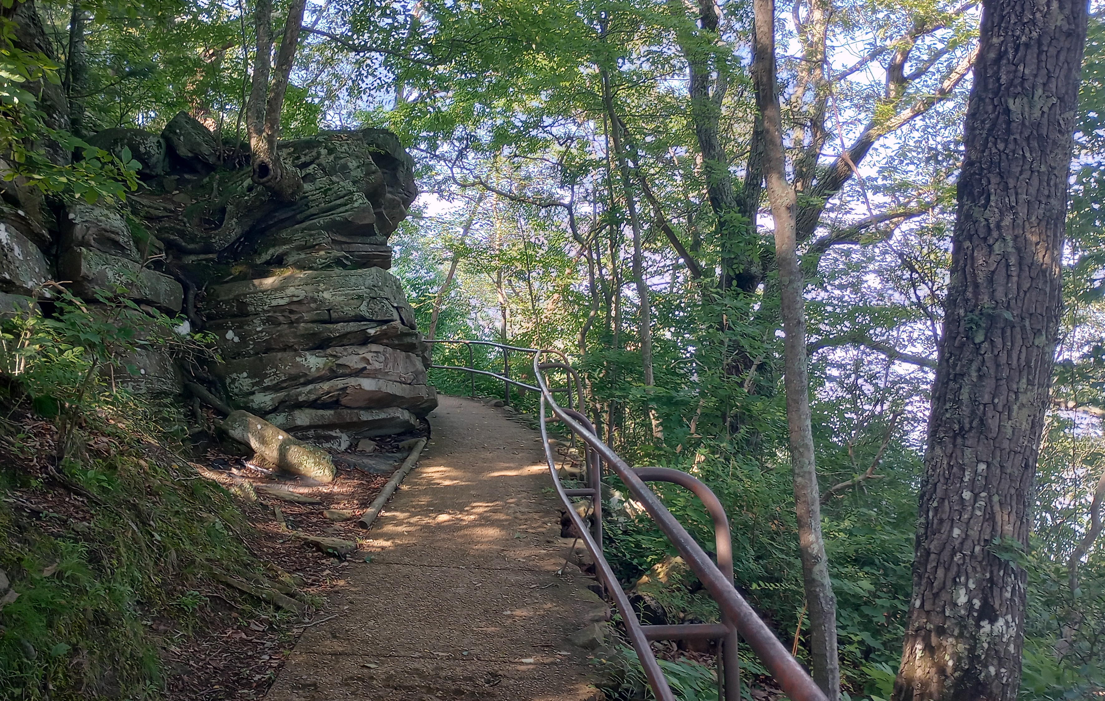
Part of the path leading to an outcropping. In the lower part of the picture is a few of the 24,562 steps. (a little exaggeration)

Some balanced rocks as you're approaching the view point.

Even on a hazy day, it is a "wow" view.

Walking down is easy, crawling back up, not so much. By then the humidity had reached near sauna level.

The view of the exit to the park. Yep, that is the Corps of Engineers symbol. 

As I was approaching the train station to go back down, I saw the car leave the station. I knew I had 15 minutes before the next one so I bought some water and cooled off in the A/C.

This gives an idea of the slope of the railroad tracks. 

Tomorrow is moving day and if I can get hitched up on the slope of the campsite, I'll be heading about 100 miles north to a TVA campground just before Knoxville, Tennessee. 

Ya'll take care of each other. Maybe, I'll Cya down the road.