Tuesday, August 13, 2019

The Streetlights Are Almost On,,, Time to Go Home

Location: Coeur d'Alene Casino; near Couer d'Alene, Idaho (elev 2,600 feet)

I'm not sure if this post will have pictures, but if there are any they were probably taken with a Nokia Lumia Icon 929 cell phone.

"The streetlights are almost on, time to go home". Sometimes it was also porch lights instead of streetlights but either one meant the day of playing was about over. During the summer and weekends, we kids would have been outside playing for the entire day. Maybe going home around noon to grab something to eat if we were in the area. The limits of our playing was how ever far you could ride your bike and still be back home by the time the streetlights came on.  People of my generation will remember that feeling, that feeling of the adventure is just about over. We never felt like we were guaranteed another adventurous day and it seemed like we lived day to day, weekend to weekend, season to season. 

For the last couple of weeks I've been trying to figure out where to go after reaching my destination of Coeur d'Alene. I'm now at the end of my stay here and need to be moving on. I thought about going to the Oregon coast and then circling south through California on my way back to Louisiana but a lot of that would be retracing some of my old route. So I figured maybe go into North Dakota since I hadn't been there before. I googled and about the only thing to see was the National Grasslands and that didn't excite me too much. I've  been to the National Parks around here so those visits were out. I thought about re-riding the Beartooth Highway and then it hit me why I didn't want to repeat things. When I rode the Beartooth Highway a couple of years ago it was a fantastic "wow", one of the best of my travels. I rode it right after it was opened up from the winter. But, I worried that if I re-rode it and it was less spectacular, would that tarnish/taint my older memories, my "silent echoes". In the future as I would look back on Beartooth, would I remember the first "wow" or the secondary, possible let-down, "oh well" ride. And that is why I believe I have been hesitant about re-tracing some of my older routes that had "wow's" on them. That doesn't mean I will never go back to places I've been. One example is the Rocky Mountain National Park which I've visited twice. However, the second trip was specifically to ride an old road that I was unable to ride the first time. I doubt if I'll go back to the park since Colorado raised the price of camping in their state parks. When I checked about possibly staying in Boyd Lake State Park, the price was $44.00 per night. That is just way too high for any state park. Perhaps for a family with little ones, but not for an old man wandering around by himself. 

I haven't counted them up lately but I've stayed in around 250 different campgrounds since I started traveling back in April of 2014. The gauge on the dash in Freedom says we've towed Liberty almost 45,000 miles around this country. I've been coast to coast and border to border. I've seen the sun rise from the Atlantic Ocean in Maine and set in the Pacific Ocean off the Oregon coast. As I think about directions to travel, there is more often than not a thought of "I've been there before", and the feeling passes. 

So, with all of that in mind,,,,, the streetlights are almost on and it's time to head home. I'll pull out tomorrow heading for home in Louisiana. Yeah, I know it's still hot but it'll be OK. There is one thing I haven't done in my travels that I will do on the way home. I've never over-nighted in a Walmart parking lot. I'll do that tomorrow night and the next night in the Walmart lots of Laurel, Montana and Sidney, Nebraska. Both days will be about 500 miles of towing along the interstate. To me, that means excellent "thinking driving". I've checked both of them out and they seem good to go. If I arrive around 9:00 pm or so, the outside temperature should be in the upper 60's to low 70's. When I bought Liberty, I specifically chose a floorplan that would allow me access to the bed, toilet, shower, bathroom sink and my Lazy-boy recliner without having to open my slide-outs. That was done for nights like the upcoming two nights in Walmart's parking lot. I'll just pull in, unplug the electrical connection between Freedom and Liberty, maybe walk to a restaurant near by, then crawl in bed for a good nights sleep. I always carry water in Liberty's tanks, so with her new water pump I'll get a nice hot shower in the mornings before hitting the road again. The hot water for the shower comes from my water heater that runs on either electricity or propane. I'm looking at the Walmart stops as adventures within themselves. One more thing to do before I,,,,,,,,,,.


Tonight's picture is from five years ago when I was camped on the shore of Lake Superior. Every evening, around dusk, most of the people in the campground would go down to the shore to watch the sun go down. These ducks were swimming to shore to roost for the night. I guess they saw "the streetlights coming on". 
Ya'll take care of each other. I'll Cya down the road. 

Monday, August 12, 2019

Coeur d'Alene, Idaho

Location: Coeur d'Alene Casino; near Coeur d'Alene, Idaho (elev. 2,600 feet)

pictures taken with Nokia Lumia Icon 929 cell phone, Google Pixel 2XL cell phone and Nikon (something 00)


Stop #13. This is as far north
as I'll be going.
Well, Coeur d'Alene was the destination I chose a little more than one month ago when I was planning this trip. There wasn't anything special about it, it was just a place that I hadn't been to and might as well go see it. In the back of my mind, I hoped to get a feeling of my father while here since he was briefly stationed here during the war. Sadly, that didn't happen. 

The trip up here from Kennewick, Washington was surprising in how much the landscape changed. Ultimately ending in tall trees everywhere. It was a very nice change since I hadn't been around trees since leaving East Texas several weeks ago.
 
As I mentioned in the last post, I picked up a new water pump for Liberty. Sure enough, the old one went out the morning I left Kennewick. I arrived at the Casino Campground soon enough to install the new one. It took about 30 minutes. I'm glad the makers of Liberty put the water pump in a convenient location.


About half way between Kennewick and Coeur d'Alene

These nice looking trees showed up about an hour before getting to Coeur d'Alene. The rain showed up too.


About 30 minutes from the campground. One thing I noticed about this area is that every farm-able piece of land is used for either growing a crop or raising animals. 

Casino Campground campsite. I got a nice site on the end.

My view out the door of Liberty.


Lake Coeur d'Alene dominates this entire area of northern Idaho and eastern Washington. It is a very large natural lake that averages about 100 feet deep. Before cars, trucks and railroads; steamboats did the work on the lake. They were packed in by mule trains in the late 1800's and assembled locally. They hauled timber, mineral ores and people all over the lake. The St. Joe river located at the southern end of the lake is also naturally navigable for quite a ways. It is supposedly the highest navigable river in the world. But, I haven't checked that out, so take it with a grain of salt. When the steamships wore out or were put out of business by the railroads, they were purposely scuttled and sunk. Some were set on fire as part of the the fourth of July celebrations. 

There are scenic boat cruises on the lake. Several of the cruises are 90 minutes long but I chose the six hour tour. It is offered only on Sunday and includes a lunch. The price was right so I signed up online and printed my ticket. When I showed up for the tour, I was surprised by the public parking near the dock. The parking price was $3.00 per hour. I thought that was a little bit high but since I didn't know the area and I didn't see any other parking lots, I had no choice.  Oh well, I would have still signed up for the cruise even if I had known about the parking price. I did think the cruise company could have mentioned the parking price on their web site. The weather was not nice. It was raining off and on with low hanging clouds and mist everywhere. The temperature was in the upper 50's. Most of the pictures look as if they were taken in black and white. Even with the bad weather, the cruise was nice and so was the fried chicken. I enjoyed both.
The day of the cruise with overcast skies. I had to turn on a space heater in Liberty to warm up after a shower.

Low hanging clouds. I hadn't seen this since I was in the Great Smoky Mountains a few years ago.

A view astern.

Nice flag flying

Those are the cheaper fishing camps. Cheaper compared to some of the multi-million dollars estates along parts of the shore.

An old railroad bridge with a swing span that has since been locked in place. The bridge and the railroad track bed has been converted into a bike path. Part of the "Rails to Trails" thing.

This is at the southern part of the lake. The cruise went about 5 miles into the St. Joe River.

One of dozens of Osprey nests on the lake. The boat captain said there are more Osprey on the lake than most anywhere else.

An old house that had no road leading to it. Boat access only.

Remnants from old piling along the shore. Timber was stationed here to be picked up by the steamboats. Some of the piling was close to 100 years old.

An older lady lives here by herself. The Captain said she usually comes out and waves as the cruise boats go by. I guess the weather kept her inside during this cruise.

My vacation home after winning the lottery. Condominiums with 7,000 square feet, boat slip and country club membership for two. 

A true floating island green at the gold course. After teeing off, you get in a boat to ride to the green. They can move the green in or out to vary the yardage. 

A look back at the boat, parking lot and weather as I was getting in Freedom. It was a good day. 

Needing something else to do, I googled what to do in Coeur d'Alene and discovered there was a "scenic byway" that passed along the eastern shore of Lake Coeur d'Alene. I drove it and was about half-way disappointed. The road is hilly and curvy, so taking pictures through the windshield was too dangerous. There were only a few pull-offs and most of those were grown up with trees blocking the view. Overall, it was a nice drive, but far from scenic.

A nice view of the lake on a better weather day.

I was able to take a couple of pictures through the windshield. 
Moving day will be Wednesday, two days from now. 

Ya'll take care of each other. I'll Cya down the road. 

Thursday, August 8, 2019

Where the Columbia and Snake Rivers Meet

Location: Hood Park CoE Campground; near Kennewick, Washington (elev 375 feet)

all pictures taken with Nokia Lumia Icon 929 cell phone

Thru Stop #12
I just realized I'm at about the same elevation that I was when I started this trip back in Louisiana. Somewhere in between I hit 11,000+ feet, I think. 

The main reason for stopping here was to see the confluence of the Snake and Columbia Rivers. I've been to the confluences of the Mississippi with the Missouri, Ohio and Red Rivers. All three visits are here in the blog somewhere. Now there will be another one. This one was a little anti-climaxic in that both the Columbia and Snake appeared to be barely flowing. Yes, they were as wide as I remember, but this time there were stationary. Maybe the Columbia picks up speed as it gets closer to the coast. I remember it to be flowing really good when I saw it last. Oh well, I came, I saw, I left. Tomorrow is moving day and I'll be heading farther north to the Coeur d'Alene, Idaho area.

This is the Sacajawea Museum. It sits in the Sacajawea State Park at the confluence of the the Snake and Columbia Rivers. The admission fee is $10.00. All of the other confluences have been free, but without a nice museum like this one. The two ladies that work there were very friendly and helpful. 

This is the confluence. Wider than the others, but not nearly as well defined. Oh well.

They have a replica of a dugout canoe near the museum. There was one like this found along the Red River last year. It had been buried for a very long time and looked eerily similar to this one.

As it happens so often, I was the only one in the park. The other two cars belong to the two ladies who work in the museum. Some other people showed up as I was leaving. 

While driving along the Columbia River, I found a nice Veterans Memorial. Job, well done to whoever is responsible.

City street on the left, Columbia River on the right. There are no levees along the river which makes it appear "more intimate" than any of the levee'ed river back east.

This is a U.S. highway that runs south of the campground and alongside the combined Columbia/Snake (now just called the Columbia. It's a very nice drive with good scenery. I had a video call with my granddaughter, Olivia, at this spot so she could see the river and the hills. It was a good drive.

Looking the other direction, downstream, at the Columbia.


I also went to the Visitors Center at the Ice Harbor Lock and Dam. It is the last dam on the Snake River before it empties into the Columbia. That thing in the front left that looks like a handicap ramp is a fish ladder. There is water flowing inside with blocks of concrete every so often so the fish can rest before jumping to the next level. Again, I was the only one there so I struck up a conversation with one of the guys in the visitors center. I mentioned I was a Civil Engineer and he said well grab a hardhat and I'll give you a tour. No cameras allowed, so not pictures. I saw where they were removing one of the turbines that had been in operation since 1962. It had been producing electricity on a regular basis for nearly 60 years. Hydroelectricity is where it's at man. 
The water pump in Liberty sounds like it is going out. I replaced it about 3 years ago when I thought the original one was going out. If I remember right, after replacing it, I realized the original one may not have actually been going out, so I kept it as a spare. But, my memory is not as good as it once was, so instead of relying on the original one, I got online and lucky me, Camping World had it one sale for 35% off. Also lucky for me, there was a Camping World just 15 miles away. So, I now have a new water pump and will install it at the next campground which should be a little cooler temperature-wise. I'm not surprised my pump is going out since I use it everyday. I always use my fresh water tank and water pump instead of hooking up to city water. I've done this since the beginning. The reasons are,,, I want to always be cycling my fresh water so it doesn't sit still and get stagnant. So many RV'ers hook up to city water and keep a little bit in their fresh water tank. When they come to a campground like I'm at now that doesn't have water at the campsite they have to use their fresh water tank and just hope it is still fresh. Second reason; when traveling, the RV bounces around so water connections can get loose. If you hook up to city water and pressurize your water lines, the water will find that leak if it exists. Hopefully, you will be in the RV when it does but it may be after lots of water has gotten everywhere. I've seen people return to their RV after being out for the day and water is just running out from underneath it. For me, all I have to do is flip the switch for my water pump and if it comes on without a faucet open, then there is a leak somewhere. I've gotten in the habit of turning it on only when I need water but there are other times when I will leave it on while I'm in the RV to check for a slow leak. I don't drink water from my fresh water tank. I use it for showering and in the kitchen sink. I chlorinate about every third tank full by adding one cup of Clorox when I fill the fresh water tank.

Well this has been a long post than I had intended. 

Ya'll take care of each other. I'll Cya down the road. 


Wednesday, August 7, 2019

No Cell Service so Playing Catch-Up

Last location: Farewell Bend State Recreation Area; Huntington, Oregon (elev. 2,100 feet)
Current location: Hood Park CoE Campground; near Kennewick, Washington (elev. 375 ft )

all pictures taken with Nokia Lumia Icon 929 cell phone

Thru Stop #12
I only stayed on night at the Farewell Bend Campground and did not have a reliable cell signal. The signal was like a revolving door, one minute no signal, the next minute 4G-LTE. It was so unreliable I couldn't post to the blog. I didn't venture into town because it appeared there wasn't much there so I just hung around the campground for the evening. Farewell Bend is located on the banks of the Snake River before it heads into the interior of Idaho before coming back west to join the Columbia at my next campground. This campground is where the pioneers on the Oregon Trail camped and said their "farewells" to the Snake after following it for 300+ miles. Except for lack of cell service, it is a good campground.

The trip from Twin Falls to here has a dramatic change in landscape. From barren, to high desert with scrub brush, to super sized irrigated fields of crops, to tall trees and everything in between.  

This is southern Idaho headed north. The interstate is still a few dozen miles away. That is the Snake River to the right.

On I-84 now. The landscape was surprisingly flat and stretches where no crops were being raised nor cattle running. 

Beginning to see some mountains in the distance.

The Snake joined the interstate before the exit to Farewell Bend Campground

Freedom and Liberty in Farewell Bend State Recreation Area.

This was just a short walk from my campsite. That is the Snake as it makes its way to the east before turning north and comes back west at my next campground. 
I arrived here at Hood Park yesterday afternoon. Wouldn't you know it, they have a mini-heat wave going on here. The temperature for yesterday and today is 103 degrees. Luckily, the humidity isn't very high so the heat index is only 106. Something isn't right when I'm using the words "luckily", "heat index 106" in the same sentence. I'll be staying here for three days so at least the third day is cooling down into the mid 90's. Some much for going to the Rockies for cooler temperatures this summer. 

Getting on I-84 after leaving Farewell Bend

The mountains are beginning to show themselves more and more.

These smaller rolling hills were in the middle


The rolling hills have their own type of beauty.

I got lucky and took this picture of an abandoned house along the interstate. I've seen these everywhere in the country,,,, must mostly west of the Mississippi River.

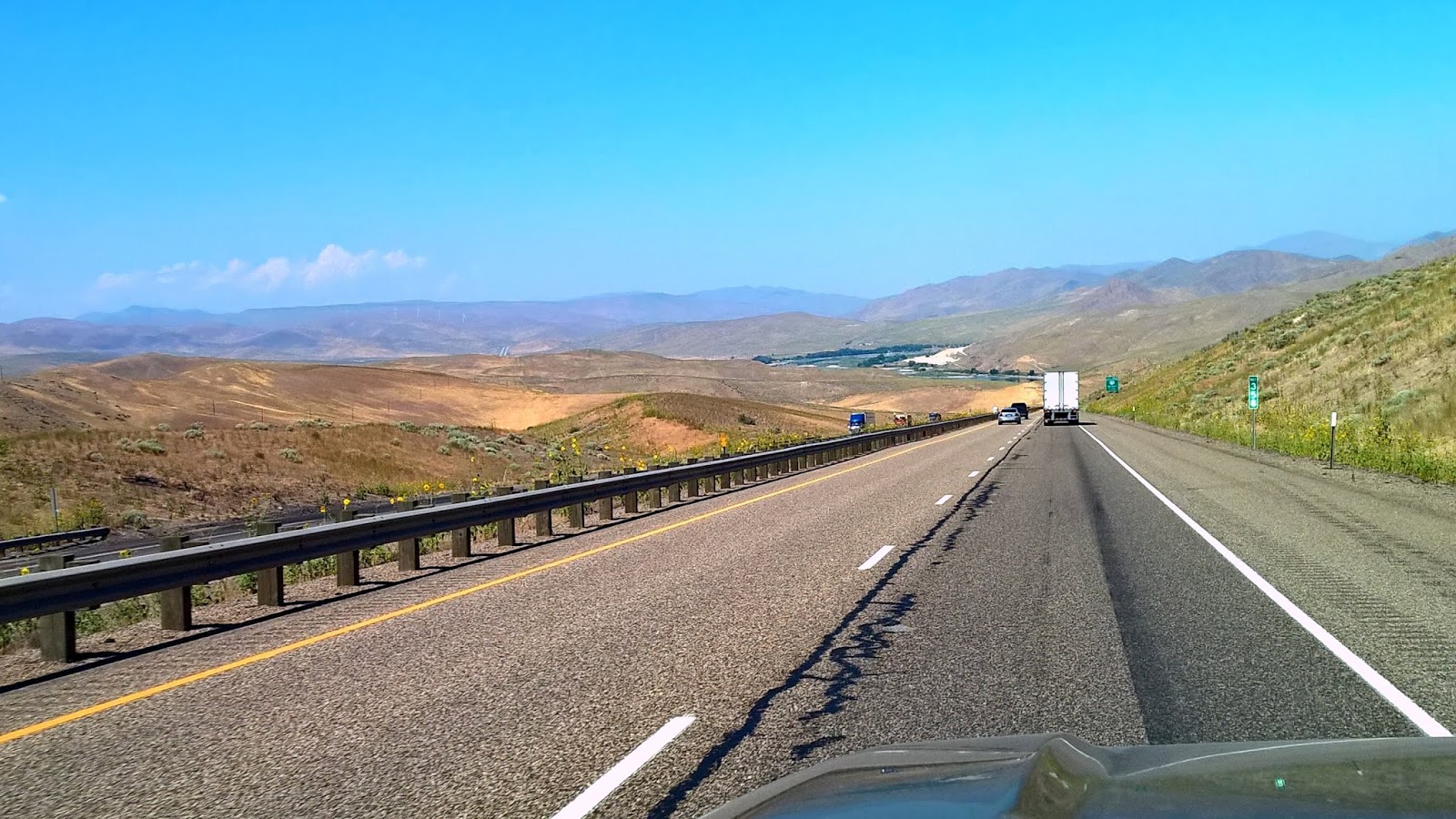
My typical "long highway" picture.

Finally trees started showing up. I haven't seen tall trees since leaving East Texas.


More tall trees. I miss them.

Campsite at Hood Park. Not bad for $12.00 a day (senior pass).
Hood Park is located near the confluence of the Snake and Columbia Rivers. I saw the Columbia River again yesterday. It has been a few years since I've seen her and she still looks great. She is one of the top three great looking rivers in the lower 48 of the U.S. After making this post, I plan to take the river road to see more of her. 

I'm off to do some exploring before the temperature gets too high. By the way, this Pacific Time Zone has me messed up real good. 

Ya'll take care of each other. I'll Cya down the road.