Tuesday, March 15, 2016

Sunrises, Beaches and Darn Bugs

Location: Silver Slipper Casino RV Park (el 5 ft); Waveland, Mississippi

All pictures taken by Nokia Lumia Icon 929 Cell Phone
(click pictures to enlarge)

Last Saturday I moved about 5 miles from Buccaneer State Park to a campgound within about 200 feet of the Gulf. I had planned to move out of the area and continue my trek eastward towards Charleston, SC, but after seeing the campground I decided to stay here for 4 days. During check-in, the casino asked if I wanted one of their tracking cards and when I hesitated, she said it comes with a complimentary one night free stay at the RV Park. I said, sure, why not. It's full hookups and Liberty is backed up right to the road with the beach just across the road. I can easily walk the beach at any time.
Camp site #7

View out the door of Liberty.
The sun rises in that direction.
I got here early Saturday because the tail end of the bad storm system that had flooded Louisiana had just passed through here. There were still some "popcorn" storms so I hitched up early and was prepared to move in between storms if necessary. I was set up at the new campground by noon. 
View from my "back yard".

Looking down the beach towards the casino

Some oil washed up after the storm system churned up the Gulf. I'm not sure if it is from the BP oil spill or not. There were so many things in this area that got wiped out during Katrina, including oil storage locations.

The remains of an old dock/pier that Katrina took out
Pieces of asphalt roadways wash up every morning. The storm surge peeled up many roads around here and took the material back out to the Gulf. 10 years later, it is still washing up.

Looking back along the beach towards Liberty during one of my walks.

A couple of birds standing on a sand bar.

One of the other things that happens on the tail end of strong storm systems is the wind is unpredictable. It can be blowing like crazy one minute, then absolutely still the next. I know now that when the wind stops blowing, if you're not covered in the correct bug spray, you better run for cover indoors. I discovered this fact during a visit with my new neighbors on the first day. They were a young couple on their first camping trip in a brand new travel trailer. We were getting to know each other when the wind stopped. It was at that instant that I barely heard the words "attack, attack". I thought I was hearing things and continued the visit. I noticed the guy had removed his hat and was swatting something around him. I felt something on my legs and looked down thinking a mosquito was biting me. Wrong! There were little bitty bugs all over my legs and they seemed to be trapped in the hair on my legs. I brushed some off but more kept coming. I then heard the words loud and clear, and they were saying "Attack, attack; on my command everyone bite". It was then I realized I was being assaulted, so I ran jogged trotted walked fast back to Liberty all the while trying to swat the bugs off of me. I didn't see the damage they had inflicted until later that evening when my legs started itching and burning with welts beginning to form. My legs looked like I had either stood still in a bed of fire ants or more likely had been shot with a shotgun full of rock salt. Nothing I tried gave me any relief and I suffered through a sleepless night. The next day I bought some old style calamine lotion which works for a couple of hours. I also found that some baby wipes with Aloe in them provided a couple hours of relief. Today is day 3 after the attack and I'm still itching, just not as bad as the first night. The bugs are called several different names such as: biting midges, sand gnats, "no see ums". I just call them "blood sucking, no good, little (*^%%$&^*^'s". So when the wind stops, run!!!!

Besides the proximity to the beach, I wanted to stay here because it is situated perfect for catching sunrises. The sun rises over the Gulf directly off of Liberty's right side with no sight obstructions. I can look out my window to see if it will be a good sunrise or not. So far, there have been 3 distinctly different sunrises and all equally nice. I hope tomorrow morning will give me another good one before I pull out.
Sunrise on Morning #1. The rays of light look like a crown


Sunrise on Morning #2. It had clouded up some but the sun shined through and laid down a " sun-path on the waters".


Sunrise on Morning #3. About 30 minutes after sunrise, a big sunbeam shined through an opening. 

This is still from Morning #3, but I liked it because of the bird. 

Tomorrow is moving day and I'll be heading to a campground in Alabama. It is located about half way between Mobile and Pensacola. I'll be there for about a week to see what is worth seeing in that area.

A cloudy sky over Liberty

Ya'll take care of each other. I'll Cya down the road.   

Friday, March 11, 2016

This and That on a Rainy Day

Location: Buccaneer State Park (el. 10 ft); Waveland, Mississippi

All pictures taken with Nokia Lumia Icon 929 cell phone
(click pictures to enlarge)

The slow moving low pressure system that has caused record setting rainfall and flooding in Louisiana finally got here last night. I have been wanting it to move faster so it will clear of this area by noon tomorrow so I can move to another campground. It looks like it will be nip and tuck as to whether I will be moving in the dry or not. The move is just down the road to a campground real close to the beach, but I would prefer doing it in the dry if possible.
A beach shot from a couple days ago

Another shot from a couple days ago where I got lucky with the bird.
My favorite beach house located just down the road from the campground. I bet there is a story about why the left porch is square and the right one is octagonal, but there was nobody around to ask. It has to be less than 10 years old since all the places were wiped out during Katrina. I was talking with a woman at the laundromat who had owned a house that was destroyed during Katrina. I asked if she had re-built. She said the insurance paid to replace the house, but she couldn't afford to rebuild because the cost of homeowners insurance had went from $1,200 per year to over $10,000 per year after Katrina. That answered my question as to why there were so many empty lots everywhere. 
This picture is from yesterday and you can see how angry the Gulf is getting as the storms get closer. I will try to get another picture after the storms arrive.


I drove to a town that doesn't exist anymore in an attempt to find the grave of my aunt. Her name was Helen and she passed away in 1920 at the age of 4. I know very, very little about her. In fact, I didn't know she had existed until about 15 years ago during a visit with my father, his sister and his sister-in-law. All have since passed away except for the sister-in-law. My father and aunt were talking about their recent trip into Mississippi to find the grave of their sister. I thought that was odd, because I didn't recall any aunts buried in Mississippi. They then told me about my Aunt Helen who died 4 years before my father was born. I asked how she died, but surprisingly, they knew very little other than she had died of some sickness. They had found the cemetery, or at least the one they thought contained her grave. The headstone, if there ever was one, had long since disappeared which would not be unusual since the family had moved away shortly after her death. My father and aunt had different recollections as to the location of her grave within the cemetery. They planned to put up a headstone if they could verify where she rested. The last time they would have been there would have been when they both were early teenagers before the family moved to Texas during the depression years of the late 1930's. I knew the name of the cemetery from some papers I had and went to see if I could find it.
Ora Cemetery where I think my Aunt Helen is buried
It was named after the town of "Ora", but looking at maps it was clear that town didn't exist anymore. I was able to find the cemetery but could not find the headstone. It is a small cemetery and I was easily able to walk the whole thing in less than 30 minutes. I guess my father and aunt couldn't verify her location accurate enough to put up a headstone. As I stood there, I wondered what has happened at this place nearly 100 years ago. I then noticed a large sawmill nearby and remembered that one of the jobs my grandfather had was a lumber grader at a sawmill. I wondered if he had worked at that mill so close to the cemetery. I then thought that the original headstone may not have been a stone at all, it could have been a wooden marker from the sawmill. That would have been commonplace back then as it would have been considerably cheaper than an stone marker and would have decayed over the decades. As I turned to leave, I told Aunt Helen, "Hello and Goodbye". I knew there would not be any other Goza's returning to this place since I had not seen a single Goza headstone and could not think of any living relatives that may know of the place. Time passes by so quickly. It was a nice road trip into the past.

Ya'll take care of each other. I'll Cya down the road.  

Sunday, March 6, 2016

Waveland and The Gulf of Mexico

Location: Buccaneer State Park (el. 10 ft); Waveland, Mississippi

all pictures taken with Nokia Lumia Icon 929 cell phone
(click pictures to enlarge)

I arrived at this state park last Thursday with plans to kick back and relax. There isn't a lot to explore in this area so I figured it would be a good time to also do some future planning while relaxing. I have driven around to find a few things of interest and of course since the beach is close by, I have done a little beach walking. I had been told about a nice little bakery in town and went to see what they had. Unfortunately, they had sold out of Banana Nut Bread (my favorite) but I did buy a loaf of Garlic/Rosemary Sourdough Bread and a muffin. The muffin was very good but I don't remember the name. The bread, while the name made it sound very good, was not very tasty at all. I'm sure it was just the combination of ingredients and not due to poor quality by the bakery.

I don't have anything else to write about, so when that happens, I post pictures with captions. :)


I see these giant American Flags every now and then while I'm traveling. I sure hope they are flying it for truly patriotic reasons, but with some of them, I have my doubts. 

This was my first view of the Gulf. Each time I see it or either of the oceans, I get a sudden sense of peace. It also occurs with large bodies of water.

There is only patches of beaches along stretches of this Beach Road. The waves are lapping right next to the roadway. I figure the road was built to handle any overtopping of it by storms.

Buccaneer State Park, site #6. The water pressure was extremely low but since I always use my fresh water tank and water pump, it was no problem.

The view as you pull out of the campground.

This was the Hurricane Katrina museum in Waveland. It was being remodeled but the lady let me in to walk around a little bit. Notice the Waterline mark on the wall. The storm surge that hit Waveland was about 30 feet high and wiped out most everything along the coast. The water went inland almost 12 miles. If Liberty had been camped here she would have been under 20 feet of water. 

This is the flag that was flying over Waveland during Katrina. It seems the white color didn't do so good. The white represents "purity and innocence". Makes you wonder if the country lost some of that during the storm.


Waveland has a nice Veterans Memorial Park located right on the beach. Nice place to sit and think.


Next to the Vet Park is one of the very best fishing piers I've ever seen. Free of charge too.

Nice lighting for night fishing

Bump outs with shade and water for group fishing


From the pier looking over to the Veterans Park


Taken from the end of the fishing pier. The while "line" is a shoal line where the steep drop-off begins. It went off in the distance for as far as I could see. 


A shot of the beach during low tide. It is very shallow for quite a ways out with some of these little islands showing up.

Picture taken while standing on one of the little islands.

A "thinking bench" looking out into the Gulf. A little too close to the road for me though. 

Nice beach picture showing the soft white sand and blue waters.

Several of the streets in Waveland have these trees providing a canopy over the road.


Ya'll take care of each other. I'll Cya down the road.


Wednesday, March 2, 2016

Random Thoughts about Engineers

Location: Farr Park RV Campground (el. 55 ft); Baton Rouge, Louisiana

(click pictures to enlarge)

I stopped at Baton Rouge to attend the Engineering Conference that is put on by the Louisiana Department of Transportation. It usually occurs every two years. Looking back, I guess I've attended about 12 to 15 of these things over the years.

I was very reflective in my thinking during this conference, since I think it may be my last. I did some in-depth people watching and saw myself in the others as they played out all of the roles that I had previously played over my career. I saw the young engineers who were full of piss and vinegar trying to learn things that weren't taught in college but at the same time, acting as if they knew it all. Then I saw the middle bunch of engineers. These are the ones who have been around the block enough to have the experience to do just about anything that is asked of them. They are at the top of their game but probably don't realize it. Sadly, each one has become jaded in different ways due to some hard knocks they have survived. I guess that is a "right of passage". The last group are the ones nearing the end of their careers or perhaps even beyond it. They are shaking hands with old friends they haven't seen in a couple of years and reminiscing about good and bad times. These are the old timers that have seen, heard or experienced just about everything. They are also the ones with the memories of things that were never written down; the "lessons learned" over several decades of work. They weren't written down because we thought the memories would last forever. Little did we know, they don't.  

The common denominator between all of the attendees is the learning. Young and old alike come there to learn new things about Engineering and Transportation. It is the love of learning that keeps engineers ticking. I know I will always be an Engineer even though I may never practice that art/skill again. Being an engineer is more a way of thinking than anything else, and that is something that just can't be switched off. 

As I walked away, it felt as though a chapter in my life was ending. I could feel the others nearby. They were the engineers that I personally have known throughout my career but who are no longer with us, except in spirit.  

Next time you go over a bridge or travel on a roadway, think of the engineers who designed and built it. It doesn't matter if it is a major structure like this Mississippi River Bridge or if it is just a bridge over a small bayou. Think also of the craftsmen, operators, inspectors and technicians who worked alongside those engineers. Yep, there are some mistakes out there, but overall, it's a darned good transportation system which just needs some tweaking and a more reliable funding source.

Tomorrow is moving day and I will be heading east to a campground near Waveland, Mississippi. Perhaps the Gulf of Mexico with its water and sand will help me get over this pensive mood.

Ya'll take care of each other. I'll Cya down the road.


Sunday, February 28, 2016

Sometimes, Indecision Can Save Your Life

Location: Farr Park RV Campground (El 25 ft); Baton Rouge, Louisiana

all pictures taken with Nokia Lumia Icon 929 cell phone
(click pictures to enlarge)

First off, I changed the layout of the blog. I haven't done anything to the layout since I started it about 2 years ago. With this change, I'm creating a wider body which I hope makes it easier to read and post pictures. We will see. Let me know if I should go back to the old layout. 

As I said in the first New Orleans post, I intended to stay in New Orleans for only 5 days but extended my stay by 3 days. I extended my stay because I couldn't decide which campground to go to after New Orleans. I knew I needed to be in Baton Rouge by the 26th or 27th so that left me 5 to 6 days for a stay somewhere in between those two cities. My thoughts were to find a campground half way between New Orleans and Baton Rouge along the Mississippi River and explore some of the old plantations along the River Road. I couldn't decide between a campground near Donaldsonville on the west side of the river and another campground about 10 miles away near Convent on the east side. Both campgrounds had their own good and bad traits and with a bridge crossing at Donaldsonville, either would be convenient for exploration. I just couldn't decide between the two. That was strange because I usually get a "good vib" about a place just by researching it. That "good vib" has been right many, many more times than it has been wrong and I have learned to trust it. I didn't know what to do so I decided to do nothing and stay put, thus the 3 day extension at Bayou Segnette. My plan was to skip the middle stay all together and get to Baton Rouge a couple days earlier than originally planned which I did on the Wednesday, the 24th. 

My indecision may have saved my life since the campground I was considering in Convent was the Sugar Hill Campground. It may not have made the news elsewhere, but a tornado blew through that campground last Tuesday evening. RV's were scattered everywhere. Some blew up like a bottle of pop that had been shaken up while others were sitting on top of other RV's. It was a mess. A couple people had died and one was missing. I haven't heard if they found him or not, but would be surprised if they haven't. Thought and prayers for them and their families.

Aerial view on the day after

Aerial view

Early on the morning after

Dogs searching the wreakage

The picture says it all

If I had not extended my stay in New Orleans, I may have been in that campground. I have dodged death a couple times in my life and each time was sobering. It was no different this time. Someone upstairs was keeping an eye out for me as usual. It was interesting in the way it was done this time. By simply making me indecisive, they knew I would stay put which was the safest place.  

Like I said, I got to Baton Rouge last Wednesday. The campground is a city operated park just off the River Road. It is conveniently located to the convention center where I will be attending the conference next week. The sites are water/electric only with 30 amp being the largest electrical hookup. The 30 amp is fine with me since I shouldn't have to run both A/C units at the same time. I will be running both electric heaters but shouldn't need both on high at the same time. I will be here 8 days which is the same amount of time I stayed at Bayou Segnette. As it was then, it will be on the upper end of my waste tank capacity, but I am sure it will all work out fine. 

I haven't done much exploring since I got here. I went into town the second day and planned to visit the State Museum but couldn't find any parking within several blocks. As I was driving around looking for parking, I noticed a crowd of people on the steps of the Capitol Building and realized it was some kind of ralley which sucked up all parking. I decided to get groceries and a haircut instead. 

I did go back on Friday and visited the museum. It was worth the $6.00 entrance fee and was an enjoyable couple hours. I intended to also visit the old State Capitol Building but as I approached it, there were at least a dozen school buses parked nearby. Literally hundreds of children were running all over the grounds and going in and out. I did not stop.
The River Road about 20
miles south of Baton Rouge

My campsite at Farr Park.
It was a little wet on the first
day but dried out quickly.

A submarine from the Civil
War found in Lake
Pontchartrain

A sign of the times during the heyday of Huey P. Long's road building years. It was a good idea, but Concrete Pavement shouldn't have been used on some of the roads. They are still causing problems today.

The sign as you enter the 3rd floor. Notice the big crawfish on top. They are much better than lobster any day.

State Capitol Building. The tallest capitol building in the country. 

Ya'll take care of each other. I'll Cya down the road. 

Tuesday, February 23, 2016

New Orleans (part 3 and last)

Location: Bayou Segnette State Park (El. ?); Westwego, Louisiana

all pictures taken with Nokia Lumia Icon 929 cell phone
(click pictures to enlarge)

As I'm writing this post, the TV is on as the local channels are reporting on tornadoes that are touching down around this area. So far, there have been 6 or more that have caused property damage, injuries and at least one death. Thoughts and prayers to those who have suffered losses. 

Tomorrow is moving day so this will be the last post from this area. One of the places I wanted to see was the location of The Battle of New Orleans. Everyone, of a certain age, is familiar with the battle from the number one hit song by Johnny Horton back in the late 50's and early 60's. It was the number one song of 1959. I was only 3 years of age at the time, but for some reason, I know every word of the song. The song is only about half accurate since the "cannons didn't melt down", the head of alligators were not filled with cannonballs, their behinds weren't powered and they didn't lose their minds when the power was touched off. But it was a good song. :)
There was a street party and parade
as I passed through the Lower Ninth
Ward neighborhood. 

Some of the places from Katrina


Entrance to the battlefield


The Battle of New Orleans was actually fought nearer the town of Chalmette which is on the east bank of the river and about 10 miles south of New Orleans. You have to go through the Lower Ninth Ward to get to Chalmette. If that name sounds familiar, it may be because it was one of the hardest hit areas from Hurricane Katrina. It's been 10 years since Katrina but there are still scars from that disaster throughout the area but more so in the Lower Ninth Ward.

The ramparts where the Americans
fought

The field that the British had to cross
except back then it was a recently
harvested cane field.

Looking along the canal that was
deepened and widened to be used
in making the rampart on the left.

Again, looking along the rampart
and canal
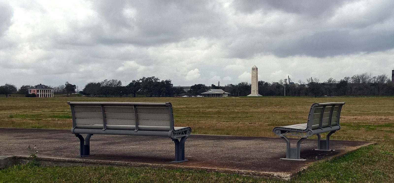
I won't get into a lot about the reasons for the War of 1812 but remember, it had only been about 30 years prior to it that we won our independence from the British. This war was like part two. One of the things the British tried to do was capture New Orleans. If they were able to do so, then they would have controlled the entire Mississippi River trade traffic. That would have prevented the westward expansion of America because if America had not been in control of New Orleans, then the Louisiana Purchase would never have occurred. The battle was very pivotal to the outcome of the war and to our country. It is surprising that its importance is not taught in the schools more. Maybe it needs a fancy name instead of just a date. 
This gives and idea how close the
river is to the battle field. I'm standing
on the river levee by the battlefield.
Notice the size of the trees that have
washed up from previous floods.

Looking back towards the battlefield.
The house was built a few decades
after the battle, but is somewhat
from the era.
Notice the watertight gate in the
flood wall. Kind of neat. 

The Riverboat Natchez was making
her tour rounds while I was on the
levee

Nice old live oaks. That is the area
where General Jackson's HQ was
located. Wouldn't you know it, the
General is in the shade while the
soldiers are in the sun. :)


One of the interesting things about the battle was the lopsided win by us. The British started out with 10,000 battle hardened men who had just defeated Napoleon in Europe. They were up against 5,000 Americans made up of regular army, local militia, volunteers and pirates. That's right, pirates. Specifically, Jean Lafitte's pirates. He had been approached by the British to join their side but chose the Americans instead. The pirates manned most of the cannons during the battle and some sources say some of the cannons came directly off of the pirate ships. Of course, Jean Lafitte didn't do anything for free. In this case he bargained for pardons for he and several of his men. General Andrew Jackson, who was in military charge of New Orleans after the battle, granted those pardons. 

The British didn't sail up the Mississippi River to get to the battlefield. Instead, they made an amphibious landing (like D-day?) with 10,000 men on the banks of Lake Borgne and then marched overland about 6 miles to the edge of the Mississippi River. It was their intention to follow the river into New Orleans. General Jackson, and his 5,000 men stood in the way. Jackson widened an existing canal that ran from the river on the west to a swamp on the east. The mud and dirt dug from the canal was used to build a shoulder high rampart strong enough to survive a hit by the British cannons. While the Americans hunkered down behind the rampart, the British were forced to march through an open field of recently harvested sugar cane. It was a slaughter. 2,000 dead and wounded on the British side and only 20 on the American side. That wasn't a typo, only 20 on the American side. 
This would have been from the British lines looking towards the American.

One of the tragic stories from the battle was about the 93rd Highlanders. These were cracker-jack, hard-ass soldiers that had been fighting around the world for the British. They were originally placed near the river but during the battle was ordered to march diagonally across the battle field to aid in the fight near the swamp. This was a stupid order because to cross the field they would have to pass in front of the British artillery which would have to stop firing until they passed. To compound the stupidity, the officer in charge of the Highlanders order them to "halt", probably with the intention of following up with another order to "kneel and fire" or something similar. But, before he could give the second order, he was shot in the head and immediately killed. Without another order, the well trained and disciplined Highlanders just stood there, with their weapons on their shoulders, as the Americans continued to shoot into them. Finally, another officer came up and took charge, but by then it was much too late for the majority of the Highlanders.

The battle lasted about 2 hours until finally the British retreated and the Americans had won the day with the war ending shortly afterwards.


The flag on the stone by the roots is
the only one I saw with a flag. 

That is the battlefield in the distance
and Freedom in the parking lot
on the other side of the fence.

Planted live oaks provide a nice,
peaceful location.

A nice picture of the 'road to infinity'

I was surprised to find a National Cemetery right next to the battlefield. It wasn't established for The Battle of New Orleans. It was established in 1864 for Union troops from battles around the Gulf area. There are 16,000 people buried there and it is now closed to any new burials although there are a few spouses and soldiers that have sites yet to be filled. There is one soldier buried in the cemetery that fought in the Battle of New Orleans but he didn't die in the battle, instead he died in route back to his home in Tennessee after the war was over. 


This is the second National Cemetery that I've accidentally found. The other was at the Battle of Little Big Horn. Along with Arlington National Cemetery, all three have a certain kind of peaceful aura surrounding them. 

Tomorrow is moving day and I'll being heading to Baton Rouge. The Engineering Conference I will be attending begins this Sunday, the 28th. It will be a short tow, so I will probably wait until around noon to pull out so the predicted high winds behind the front that is passing through will have time to calm down.
This is the reason I don't like big cities because they usually mean big traffic jams.

I had to get at least one picture of the Superdome
Ya'll take care of each other. I'll Cya down the road.